Home » Walks
Category Archives: Walks
The Winterbourne from source to the Ouse, Lewes, East Sussex


The Winterbourne is a fascinating seasonal stream which runs through Lewes from a spot just east of the Starbucks (formerly the Newmarket Inn) running alongside the A27 Brighton Road heading east, through Lewes, and entering the River Ouse from the Railway Land Wildlife Trust next to the Linklater Pavilion.

Marcus Taylor, who has lived in Lewes since the late 1960s, taught Geography for 35 years and was a trustee of Friends of Lewes for a decade explained the history of geography of the Winterbourne in an illustrated talk; it was the inspirations for this post and my own research.


The word ‘Winterbourne’, describes what is, for much of the year a dry channel. It is a stream or brook that is ‘born again’ in the winter, once the water table has risen high enough – though it failed for two years in the late 1980s and some years will be late to run, and early to run dry. Living close by for the last 15 years I can record that the Winterbourne has run, even flooded occasionally, though never earlier than December and then sometimes lasting in flow through to early May before drying out completely for the rest of summer and autumn. That said, adding this note on 22 June 2023, after a wet spring, the Winterbourne is slow flowing.

The source of the Winterbourne lies somewhere west of the former Newmarket Inn (a Starbucks since the early summer of 2023). The spring is illusive – it is somewhere in a ditch between the A27 and the railway in the lowest lying land that drops down from the Downs north and south. It is only obvious when the water table is high.


Anyone travelling regularly on the A27 will be familiar with flooding between the Ashcombe Roundabout and Newmarket Inn, for short spells these days after intense rainfall (early September 2022) or every five or so years in December after a longer period of rain when the water table has been saturated.
In the 1960s water flooded the Brighton Road and was photographed flooding off the Downs in a torrent. It did the same in October 2000 – a harbinger of flooding across the low lying parts of the town.
From an inauspicious start in a hard-to-find spring, followed by a short section of ditch, the Winterbourne, in short order, somewhere around Ashcombe Hollow, is channelled under the A27 dual-carriageway, the roundabout and Bright to Lewes rail line, only to reappear intermittently (if at all) as a stream or ditch between the Brighton Road into Lewes and Hamsey Riding Stables. It finally emerges from a large drainage pipe or tunnel next to Houndean Allotments.


The banks of the Winterbourne are dark and damp enough to favour ferns. On the right the oh too close A27 dual-carriageway thunders by; at one spot (there must be others unless everything is funnelled in through this one spot) the A27 run-off drains into the Winterbourne.


On the opposite side are Houndean Allotments. This year there was some water flow along the higher reaches of the Winterbourne from 17th October.


Onwards under a canopy of leaves in summer you might spot the four strange sculptures before you get to a patch of lawn and Lewes Pigeon fanciers.


Once again, the Winterbourne is channelled under the Brighton to Eastbourne rail line, only to emerge close to the detached houses along Glebe Close, running in a ditch by the road opposite the WInterbourne Stores and over the back garden fences of houses along Winterbourne Close.


The Winterbourne then runs along Winterbourne Lane, close to the road and verges on its northern bank and abuts to the rear gardens of Winterbourn Close to the south. At the foot of Delaware Road there is a measurement station.


The Winterbourne then runs under Bell Lane and along Winterbourne Mews.
Sadly there is an issue with garden and household waste being dumped over the back of garden fences here and fly tipping from the lane.


This is another stretch of road often prone to flooding with rainwater quickly pooling in the south-westerly corner of Bell Lane Park exactly where there is a pedestrian crossing.


The Winterbourne is culverted on two sides by concrete and walls behind the stone or flint walls of the Cemetery on one side and Bell Lane on the other.


Historically Bell Lane has flooded, turning it into an impromptu lake on one occasion in the late 1960s. There were floods the length of the Winterbourne through to St Pancras Stores and beyond in October 2000, and before that in 1915 and 1911.

There is another measuring station where the Winterbourne leaves Bell Lane Park where these ia an impressively old pollarded willow bricked into a garden wall.


As it passes through the south of the town the Winterbourne is either culverted or covered. Grills at various places where the Winterbourne enters a tunnel collect flotsam and jetsam and are from time to time cleared by the Environment Agency.
The Winterbourne is culverted for the last stretch of Bell Lane, going under the houses at St. Pancras, emerging for a short section by St Pancras Stores, then disappearing under St Pancras Road. This is site of some historic photographs of flooding at the beginning of the 20th century.

It then passes under The Course, under Southover and Western Roads Schools and sports fields only to re-emerge in Southover Gardens where it is a feature of Grange Gardens.


It then passes out of sight once more …
… passing under Gardens Street, the houses of Tanners Brook and the old Market, then under the Railway Station and lines to London/Eastbourne only to re-emerge just north of the rail line to Eastbourne, in an area that once included a manor house and formal gardens, the line to Uckfield with numerous sidings – it is now collectively the Lewes Railway Land Wildlife Nature Reserve, which includes the former gardens and pond of Leighside House.


The Reserve consists of five distinct sections: a wet wood (former Leighside House Gardens), the Heart of Reeds, the developing meadow created where the railway sidings were most densely packed, the former allotments, the river bank and the water meadow.


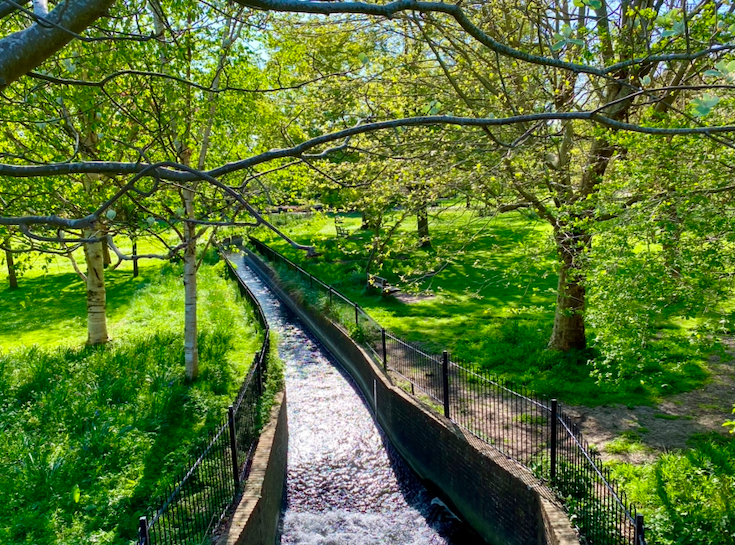
The Winterbourne passes through the former gardens of Leighside House with its restored pond and viewing platform to the north by the entrance from Court Road and then winds its way towards the River Ouse which it enters via a sluice just to the south east of the Linklater Pavilion. Currently (June 2023) works have begun to restore the Winterbourne’s natural features.

This will create more diverse habitats with deflectors fixed in the channel to create a variety of water depths, eddies and pools; brushy berms to create narrower areas to create faster water flow and planting țo create dense thickets and copses for wildlife.


In March each year grey mullet can sometimes be seen in. a large shole by the spot where the Winterbourne joins the River Ouse.


And so, for now, ends my story of the Winterbourne, which can only be followed by adding stories of these who lived beside it: those keeping horses in the fields alongside the A27, people who have an allotment in Houndean, the pigeon fanciers and sculptor, the dog walkers and runners, those with gardens abutting the Winterbourne, use Bell Lane (recreation ground), living on Rotten Row, St Pancras and the Grange, along to Southover Gardens – its house, cafe, Sussex Arts & Crafts gallery and annual skittles show, to the station and beyond to the stream’s terminus in the Railway Land Nature Reserve with its hub, the history of the old railway sidings and Leighside House and gardens, the Linklater Pavilion and the constant activity it attracts.
Hempstead Wood, East Sussex
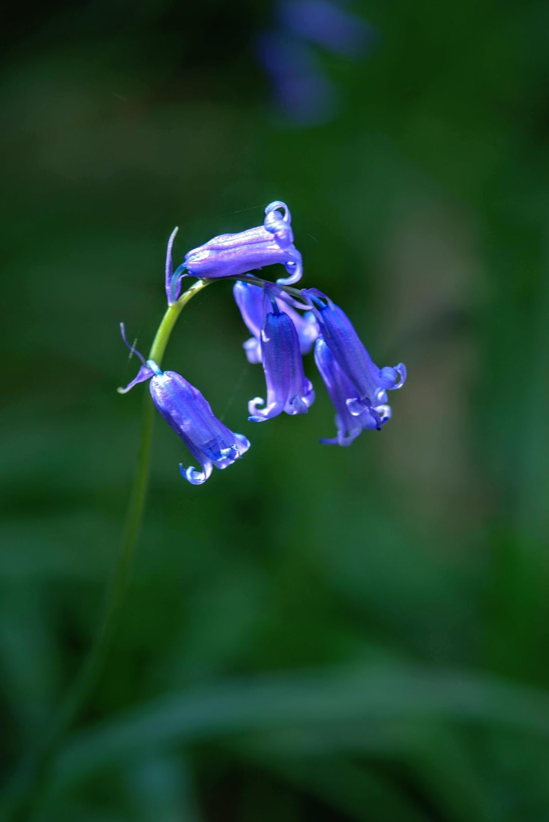
Wood anemones, wild garlic and bluebells at their very best.
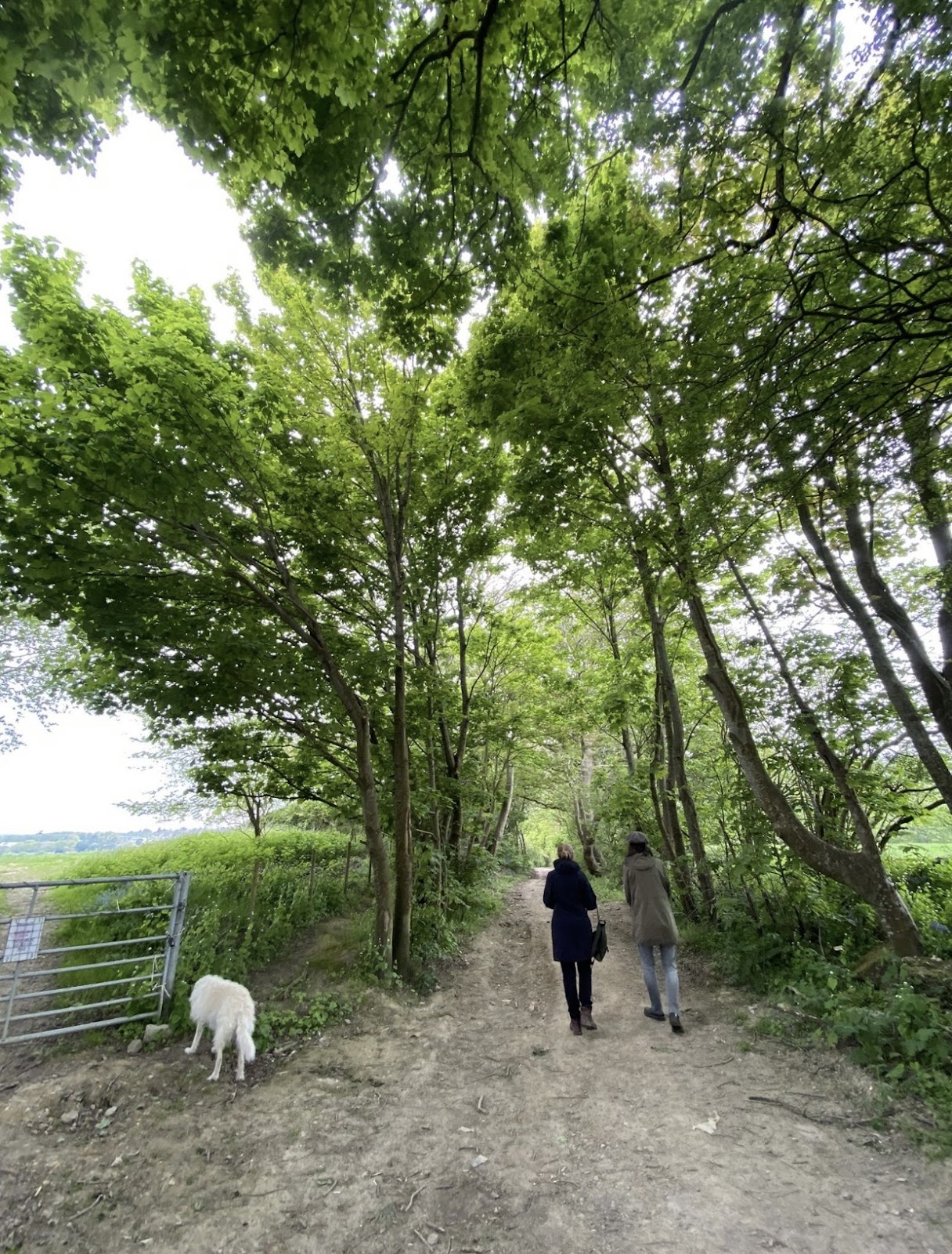
Picking my way around the woods of Sussex and having often visited the Woodland Trust Woods around Uckfield: Lake Wood and Views Wood, as well as Buxted Park I thought I’d try others from the handy Woodland Trust ‘Wood Finder’. This is how I found myself driving through ‘old’ Uckfield and out towards the east and Framfield along Sandy Lane. This was mid-April (12th April). I have been back several times since (13th, 28th & 29th April and early May: 1st and 2nd) – alone, with our dog, with family and friends. There is often no one around; sometimes a solo dog walker. There are stick dens scattered about so clearly kids come here at weekends or holidays. It is a short walk from Uckfield and easily reached by road.
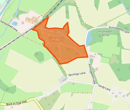
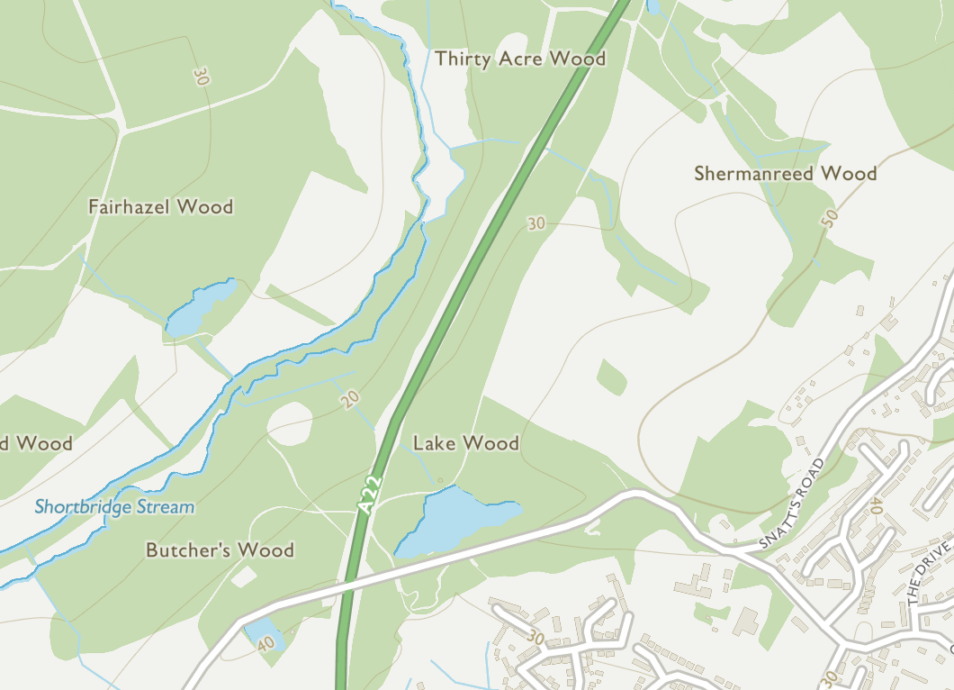
Location of Hempstead Wood, west of Uckfield (cc OpenStreetMap 2022)
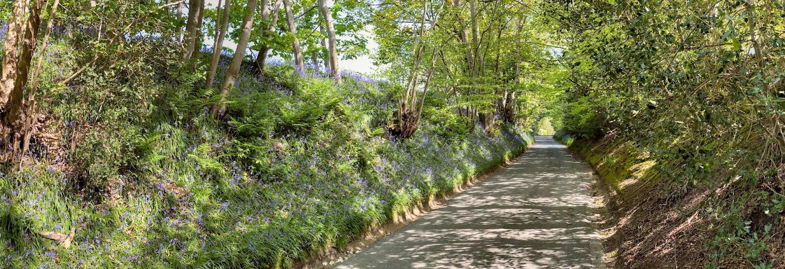
Leaving Uckfield you soon find yourself on Sandy Lane which is in itself a delight, with steep banks covered in bluebells from mid-April to mid-May and mature trees overhanging the road. If you know someone who has mobility issues who would like to see the woods in spring this is one of several lanes around Sussex which do the job.
Hempstead Wood is ‘ancient woodland of the low weald’ (Woodland Trust) and would once have formed part of an ancient wood that stretched right across Sussex to Kent. Indeed many place names are indicative of a ‘clearing in the woods’.
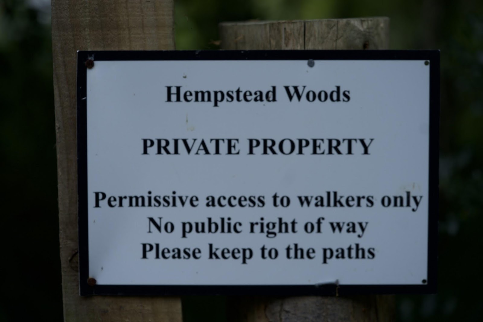
There is parking off Sandy Lane for four cars at most: there is a sign asking that the farm gate is kept clear.
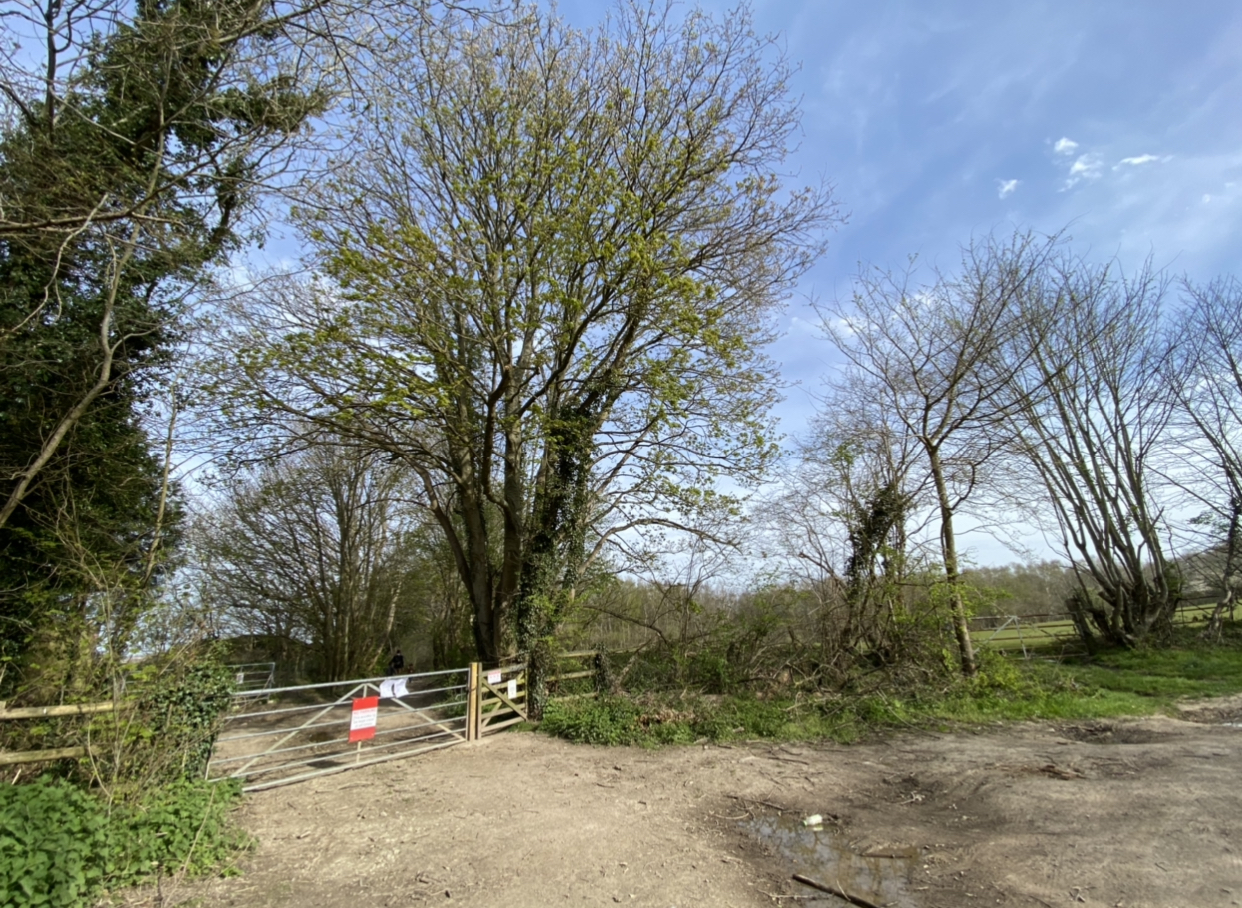
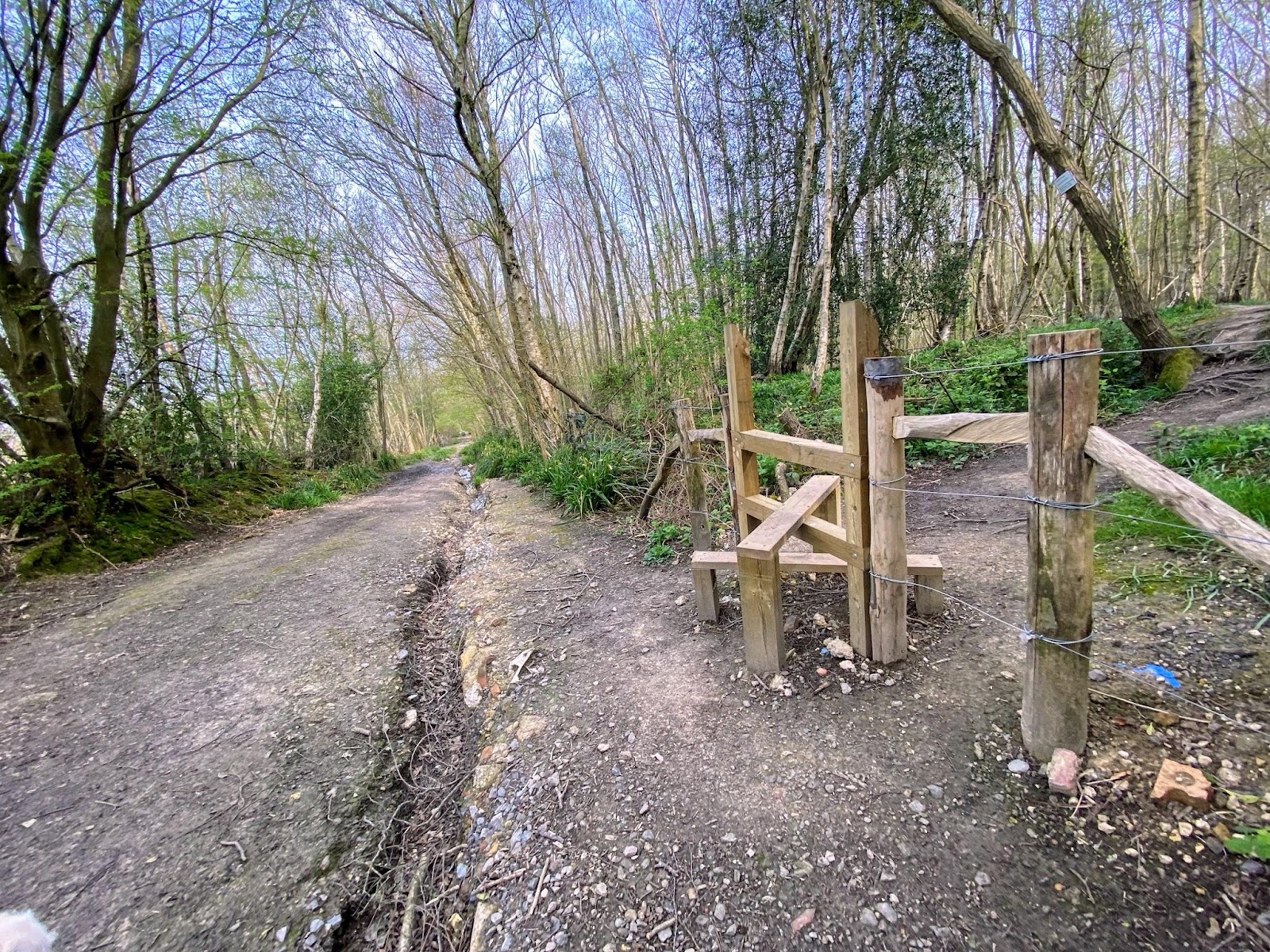
Hempstead Wood is a private wood. Bikes are not permitted and access for them has been restricted by new fencing. There is a rough track packed with rumble and in places deeply incised by the rain that runs steeply down the east side of the wood; the entrance to the woods propper is via a smart stile on the right some 170 metres down the lane. Signs restate that this is a private wood and asks that people stick to the paths; there is also a sign banning bikes.
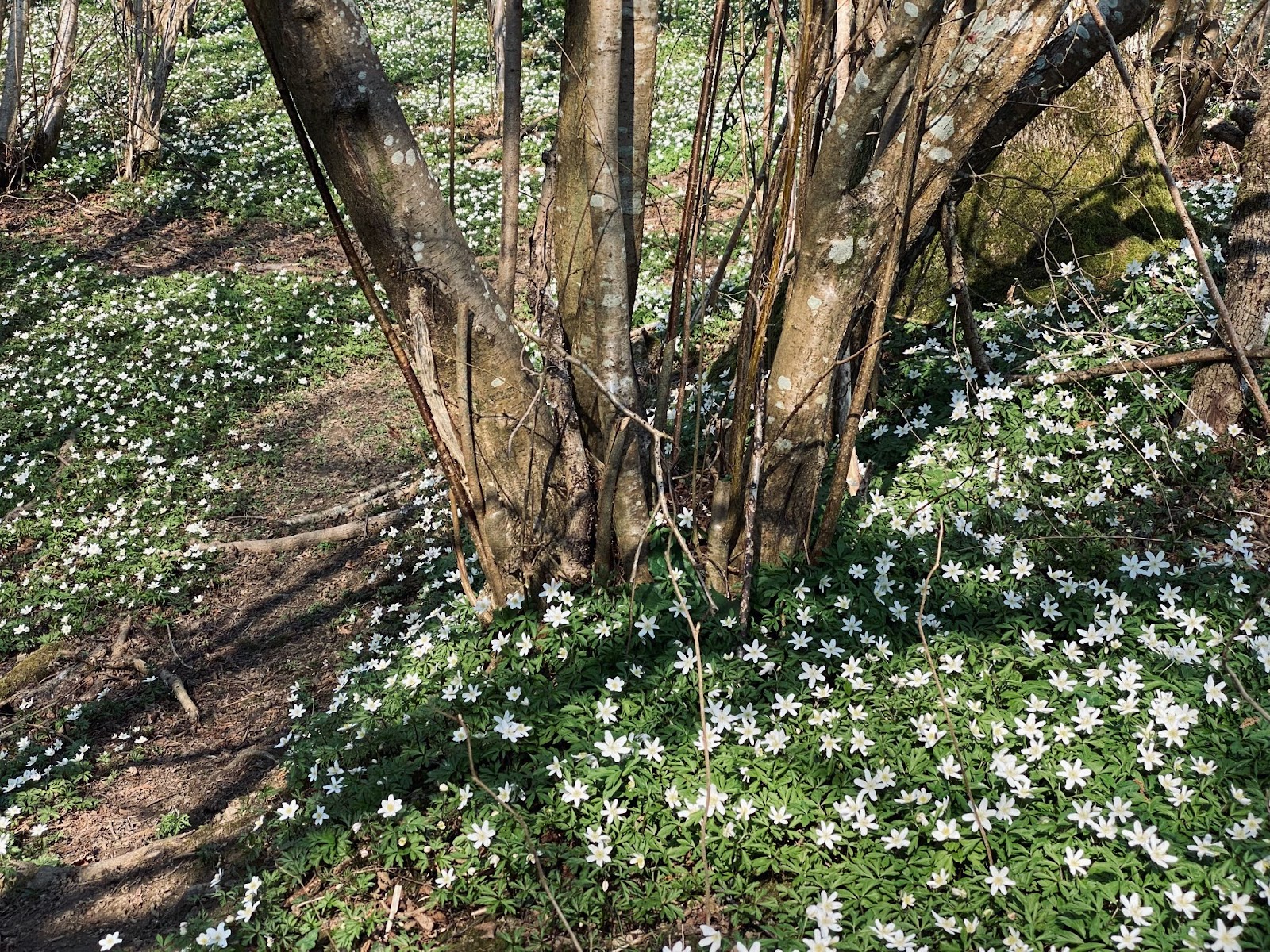
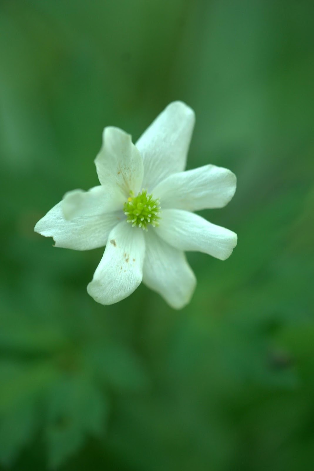
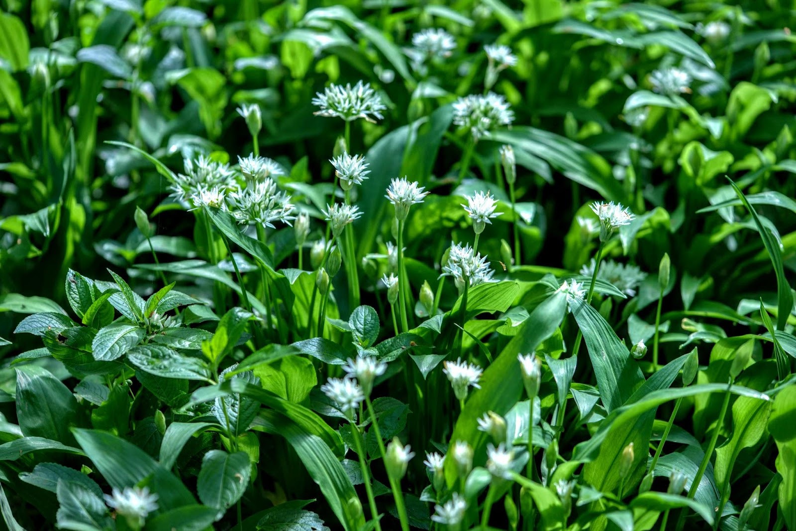
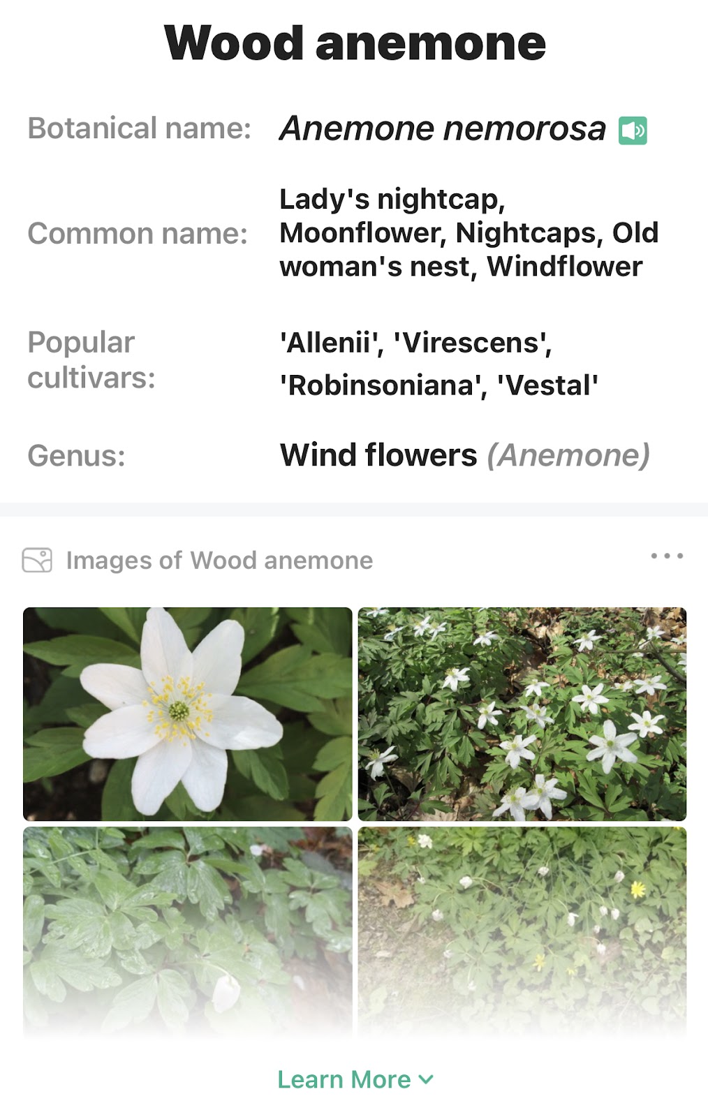
In spring there are a number of clear stages in the wood marked at first by wood anemones followed by wild garlic before it flowers and then by bluebells and before the tree canopy encloses all.
The wood anemones bloom early to create an ever denser speckled carpet of white and then the flowers disappear quite quickly as leaves appear on the trees.
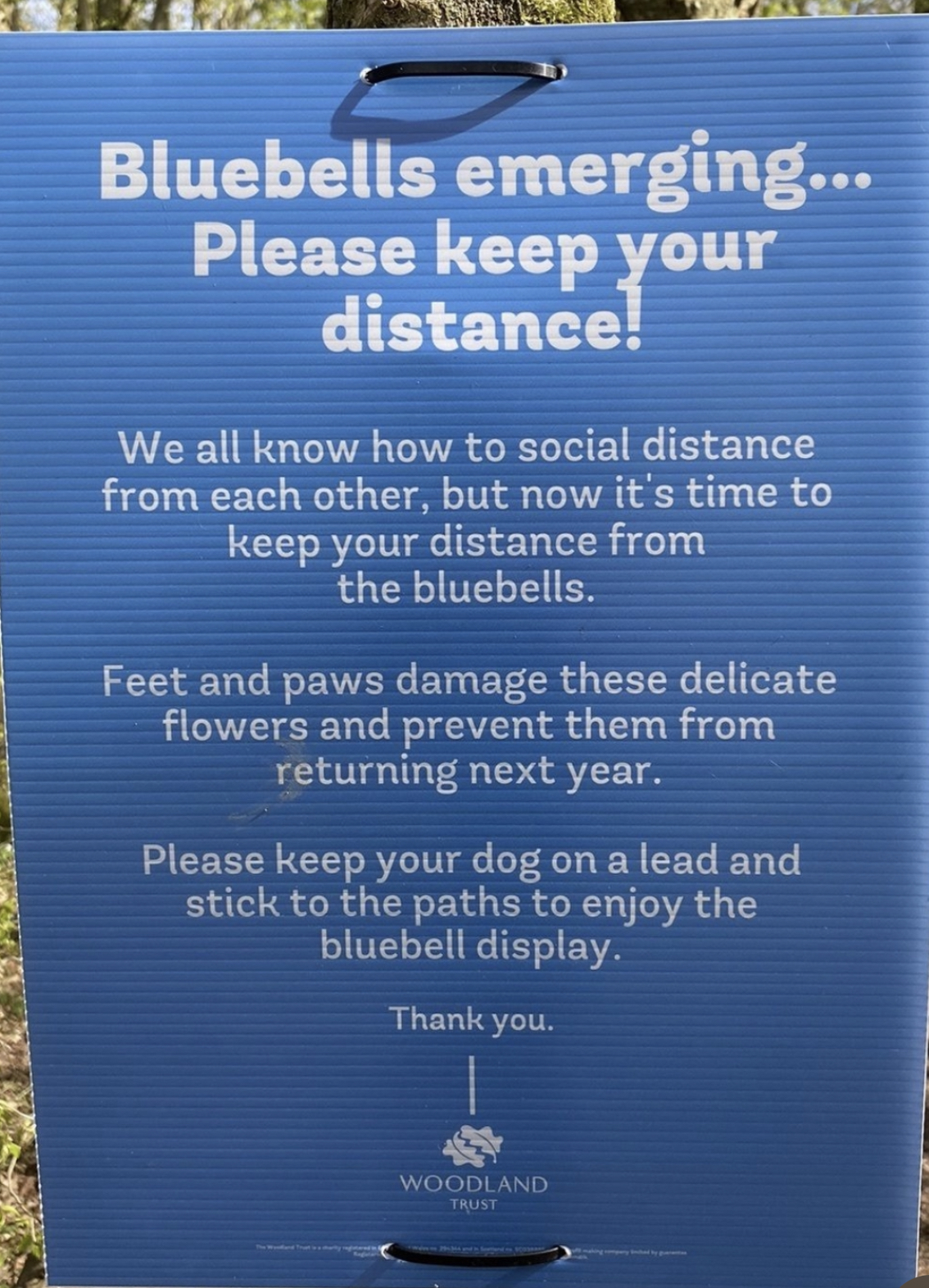
Bluebells follow at first forming a dense matting of leaves before the distinctive flowers emerge and stretch a foot or more above ground.
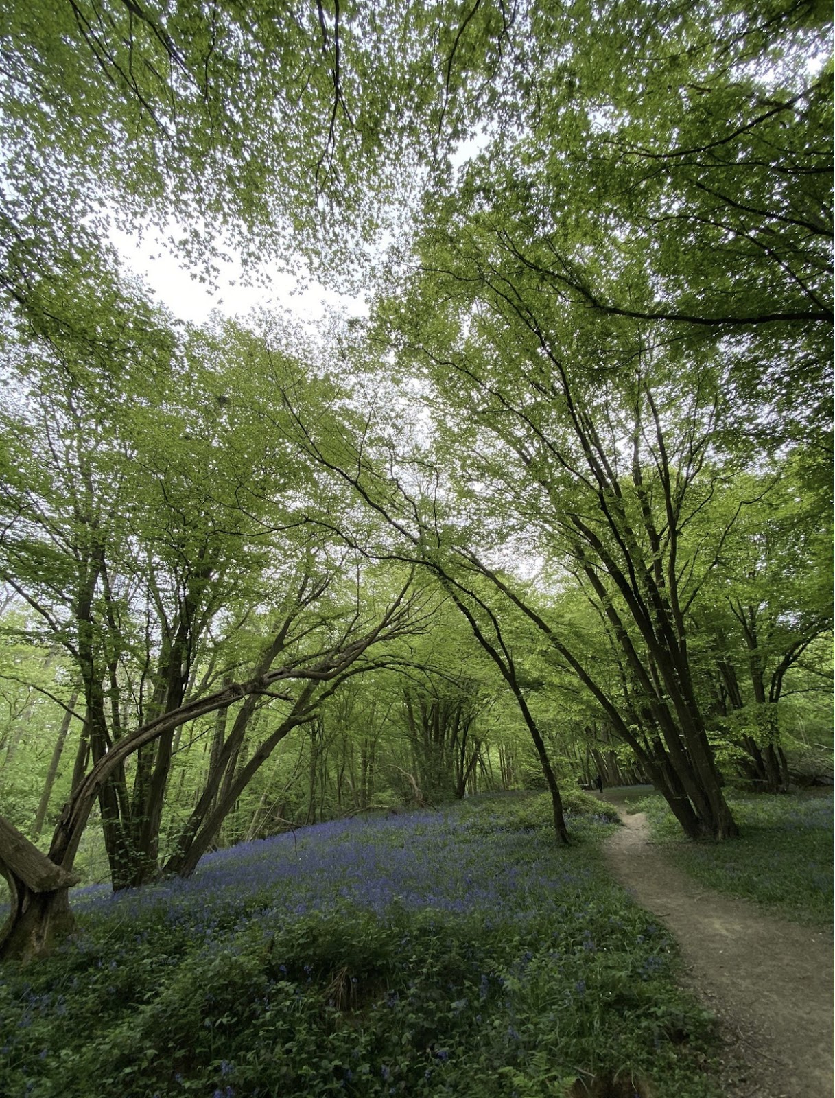
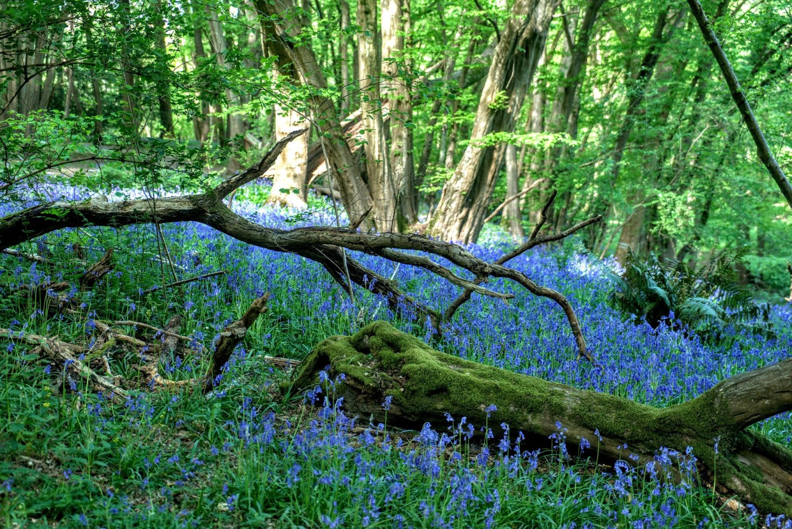

Bluebell bulbs are easily damaged by trampling by footfall and dogs. This means that they can’t produce enough energy to flower and reproduce in subsequent years. There is a request to stick to the ‘path’ but with multiple paths around the wood these can be hard to define; sadly there are many additional paths being made through the bluebells which could in time cause fragmentation of the colonies.
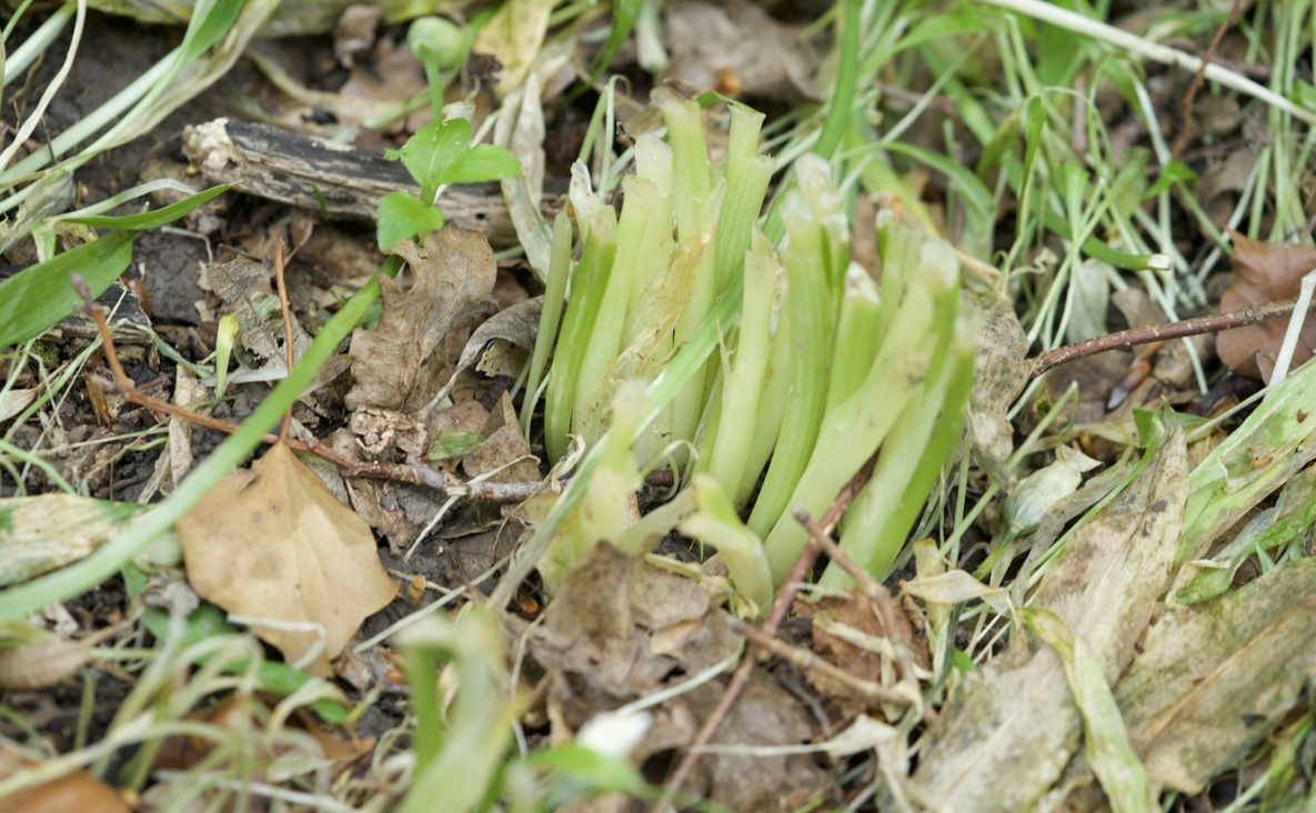
In mid-April the wild garlic had not flowered.
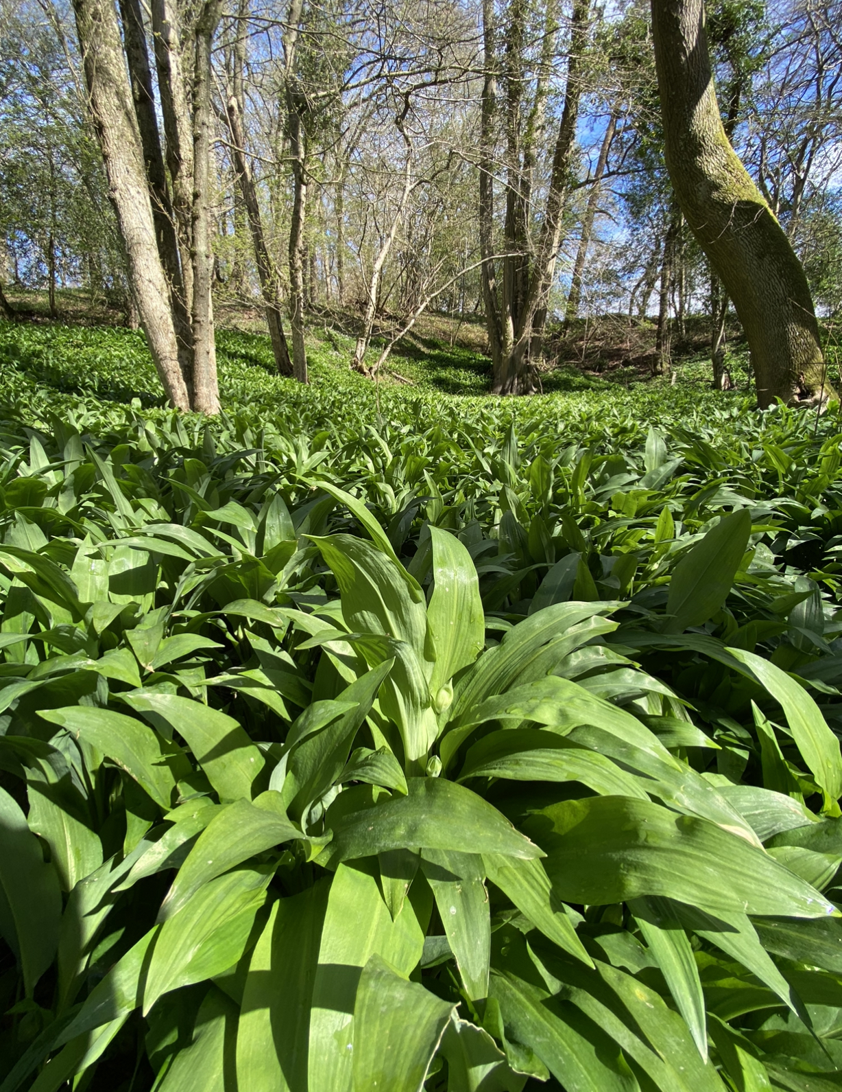
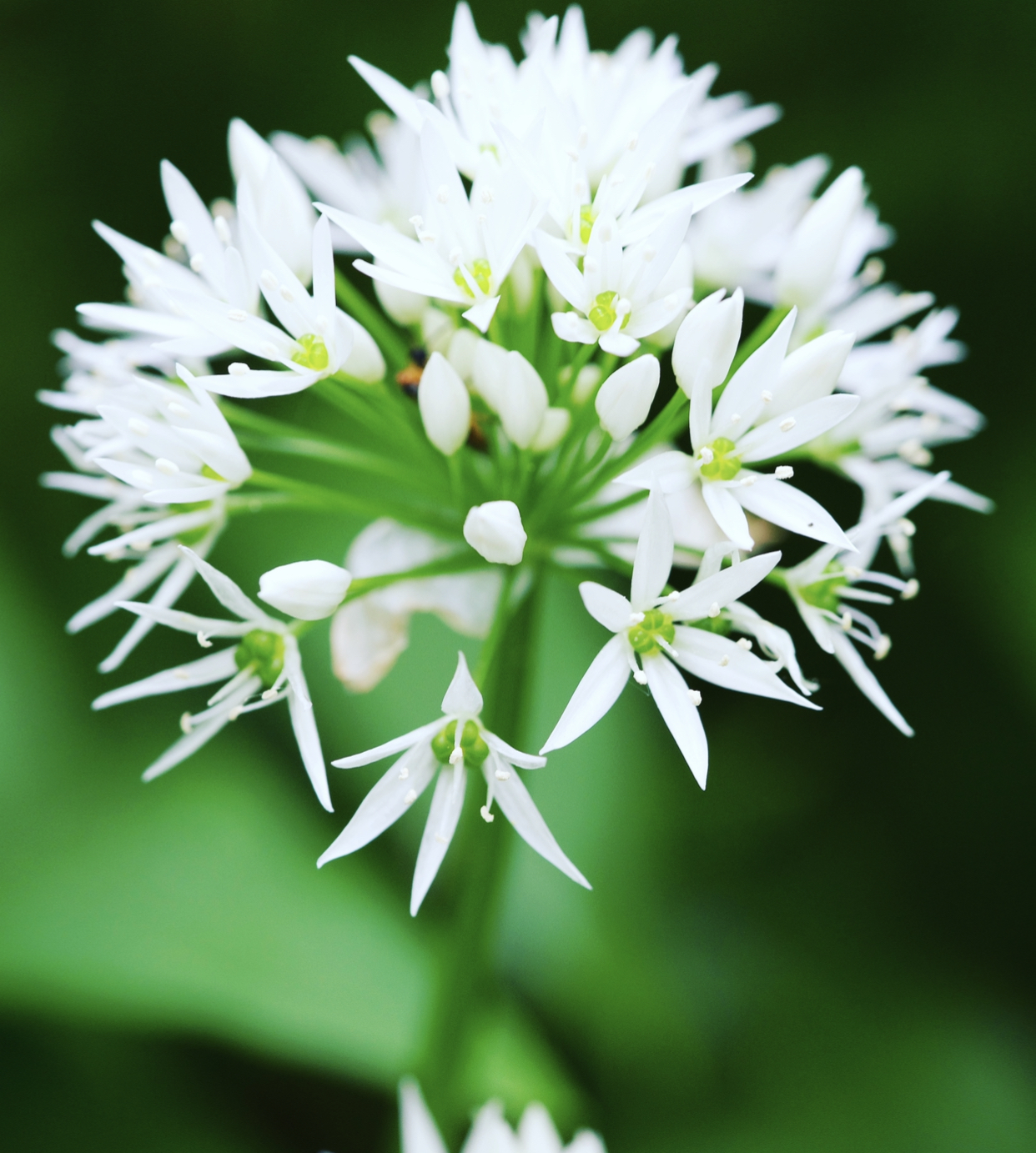
A week later flower stems with tear-drop-like bulbs emerged, finally opening into a chandelier of small white flowers at the beginning of May.
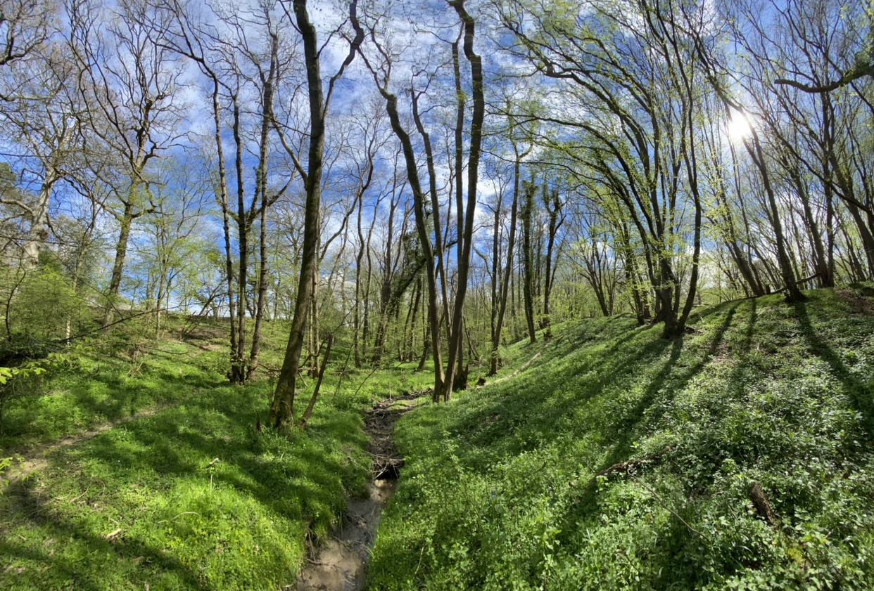
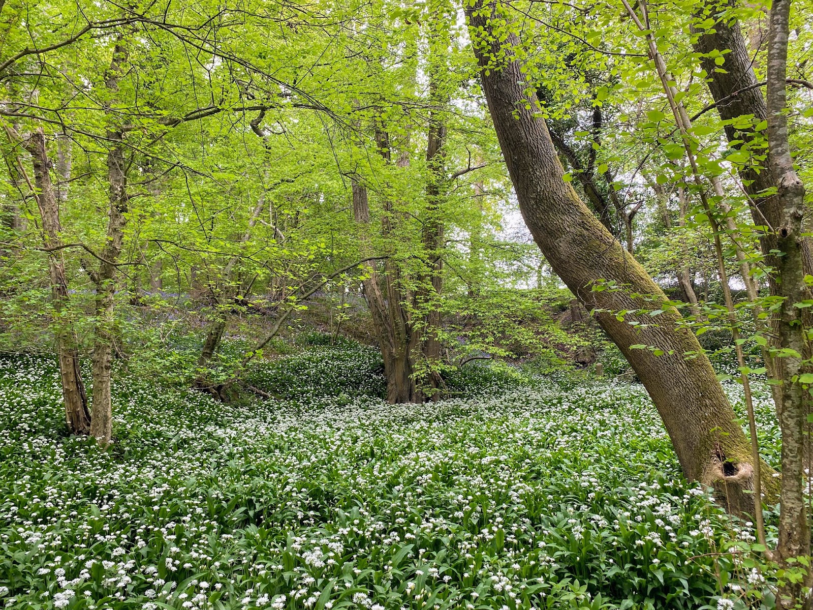
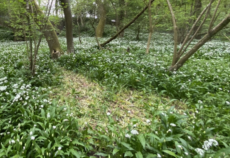
The wild garlic here is extensive and covers the damp banks of a seasonal stream that runs through the wood. There are multiple similar beds of wild garlic in many of the woods I have visited, with leaves appearing as early as 11 February on the High Weald.
Sadly, there has been some severe cropping with a scythe in patches.
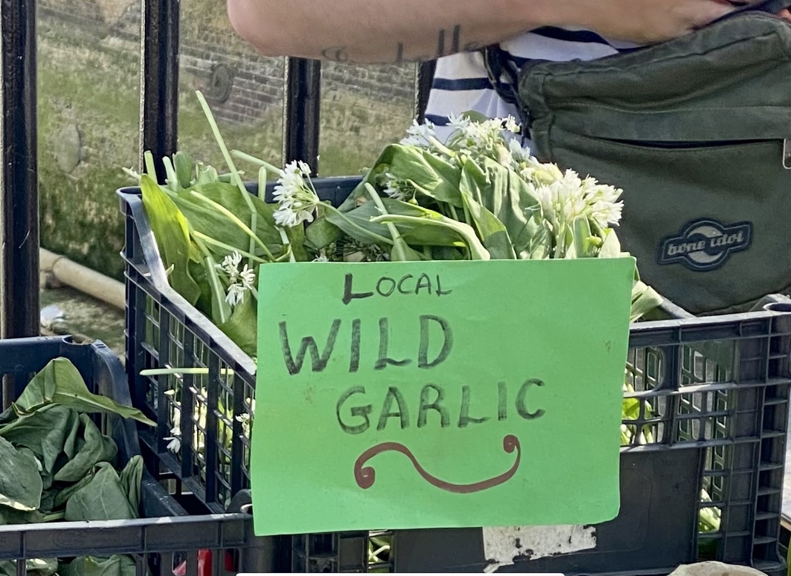
Whilst Woodland Trust woods permit foraging and guidelines are provided; namely, picking only a few young leaves from any one plant, here in a private wood this ought not to be going on.
Finding wild garlic on sale in local markets is a worrying trend.
A circuit around Hempstead Wood might take 45 minutes; this can be extended by adding a short walk onto the meadow above the Uckfield rail line then back to Spring Lane. There’s an option here to cross the railway line and head into Buxted Deer Park beyond.
As well as the wood anemones, bluebells, wild garlic and tree canopy there are a few early purple orchids, cuckoo flowers and primrose. On different trips we have seen a jay and woodpeckers.
I’ve only seen this sign up in one place, Brede High Wood (early in the season when there were no bluebells to see at all). I rather think these are needed elsewhere otherwise, where they have the resources, owners will fence of the only ‘right of way’, which in some cases can be quite brutal with barbed wire fencing keeping walkes to a single, narrow and well-worn track.
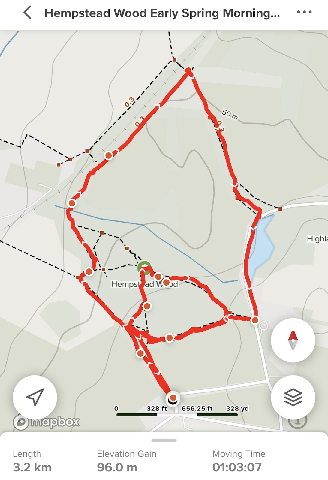
For all walks I use the App ‘All Trails’ and for plant and tree identification I use ‘PictureThis plant identifier’.
I only discovered Hempstead Wood in April; most of the woods I visit, Woodland Trust and others around Uckfield, Blackboys, Tunbridge Wells and Hastings I have been visiting since December 2021, some since October. I have therefore had the chance to see them in late summer, autumn, through winter, early and now late spring. Other woods, heaths and parks visited include: Little Foxes Wood, Lake Wood, Views Wood, Moat Wood, Kiln Wood, William’s Wood, Beechwood Mill and Brede High Wood, as well as Buxted Park, Laughton Common Wood, Chailey Common and Markstakes Common.
Further advice and information
Botanical Society of Britain & Ireland
Natural England – The Countryside Code (link to PDF)
Forestry Commission – New Forest Fungi Code Q and As
Scottish Natural Heritage – Scottish Wild Mushroom Code
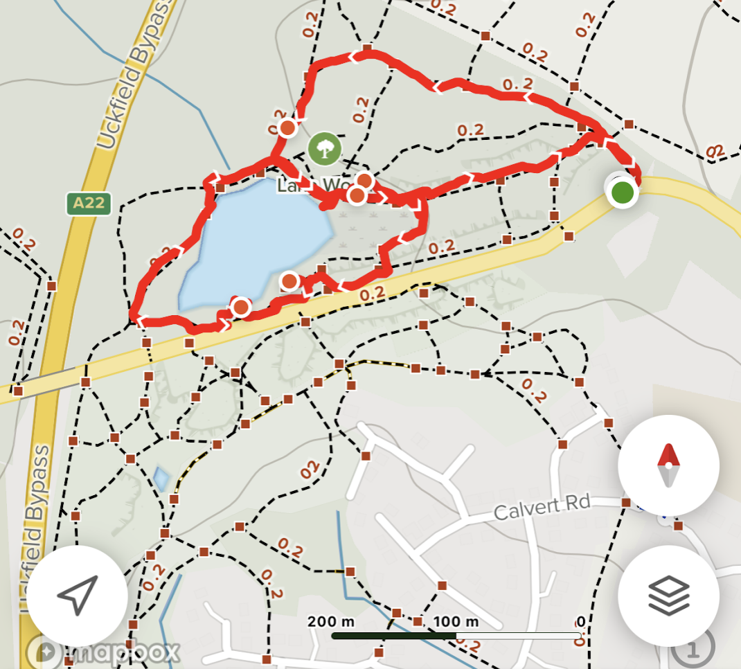
Lake Wood, Rocks Road, Uckfield early Spring
I’ve returned to Lake Wood every month for the last six months of so. This has allowed me to see the area through the changing seasons and weather conditions; wet, dry, cool and cold. There has been no snow this year and little frost.
The plus side to this walk is the landscaped grounds around the lake with its older specimen trees (around 150 years old) and the gradual ‘re-wilding’ thanks to the work of The Woodland Trust. The down side is its popularity at weekends and during holidays, with likely litter and the noise from the busy Uckfield by-pass and Rock’s Road.
In previous posts I’ve referred to the Woodland Trust Management Plan; this is always a great place to start. You are spoilt for detail on what is to be found, the work done to date, then short and long term management plans. Few of us will live the 50 years to see these come to fruition. Who knows what climate change will have done to adjust this planning by then. This year spring has sprung at least a week early. The wood floor has been dense with wood anemone’s for a while.


I use AllTrails religiously, even when I have done the walk several times. This walk took us closer to the A22 and traffic.
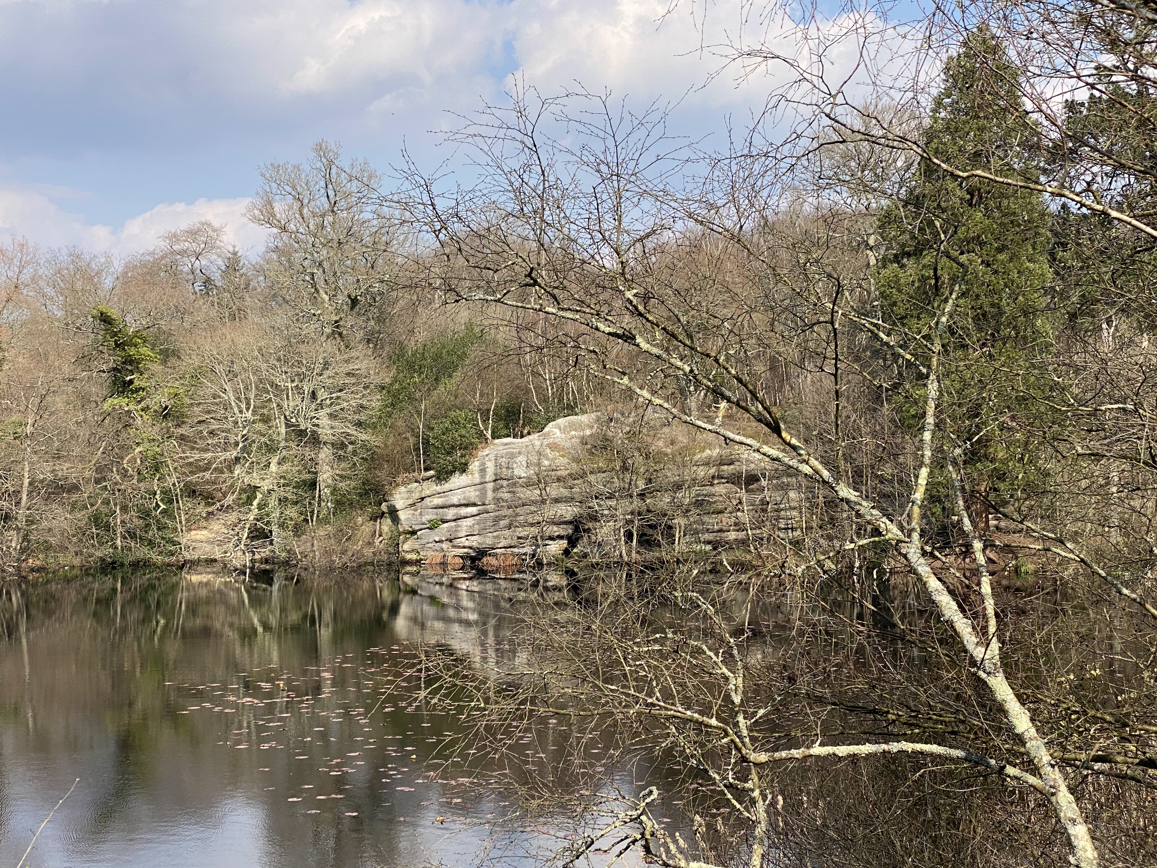
The broader views across the lake have changed little over the last few months.


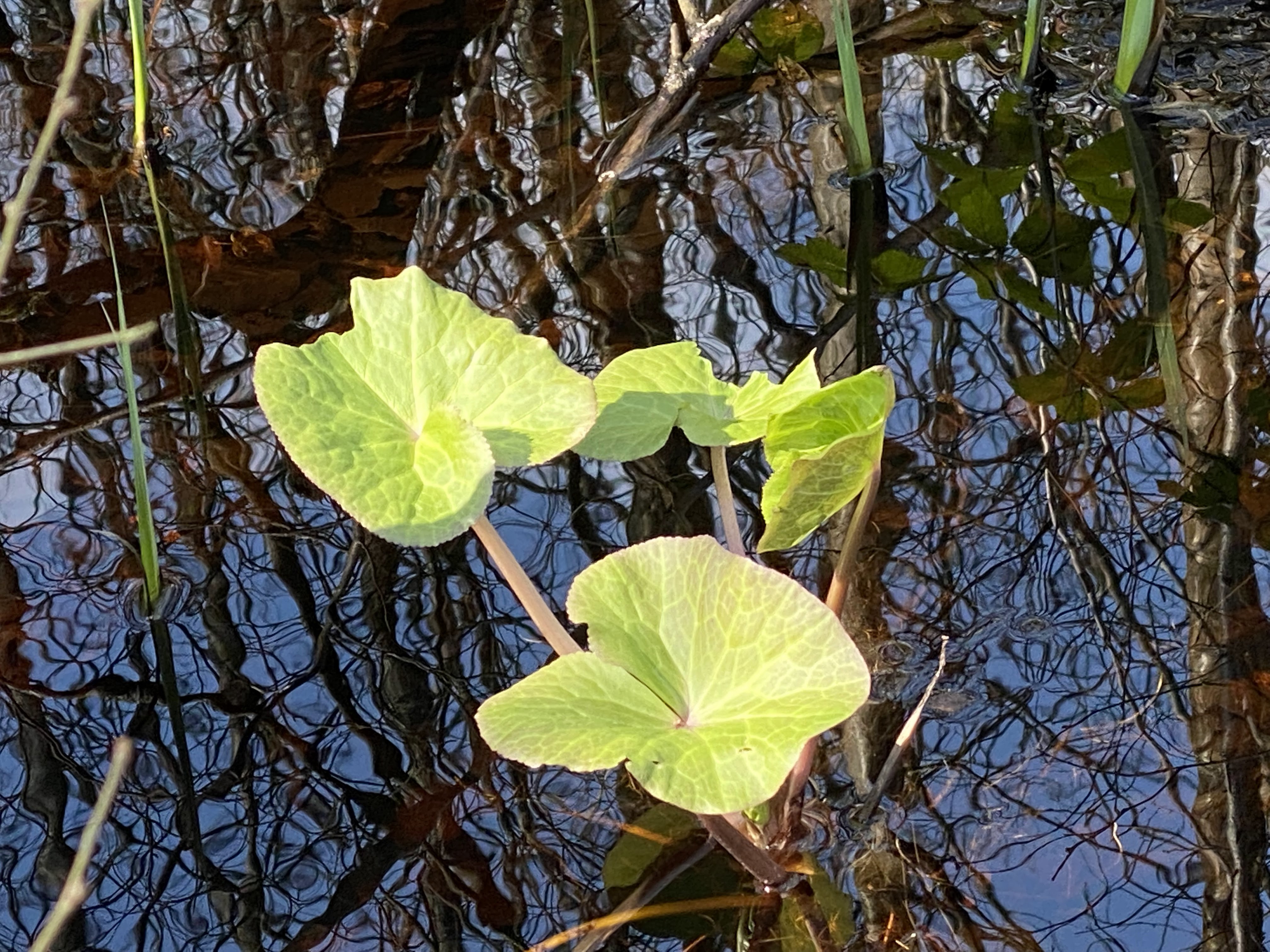
Closer up, in the shallows of the marshy ground, there are signs of Yellow Marsh Marigold and rushes.

The next visit will take me outside the Lake Wood managed area either across the open meadow towards Longwood Gill and Shemanreed Wood or across the A22 to Butcher’s Wood. Sadly, both are likely to suffer from noise pollution from the A22. We’ll see!