Home » Posts tagged 'lewes'
Tag Archives: lewes
Lewes Notable and Veteran Trees
As a volunteer for the Woodland Trust, I have taken on several 1 km squares to survey. These include 4 km centred over the north, south, east, and west of Markstakes Common near South Chailey – and where I live: Lewes—the south of Lewes down from the Brighton Road and the High Street, bordering the Winterbourne stream to the Brighton to Eastbourne railway and A27 Lewes bypass.
My expectations were that I would find nothing more than a handful of ‘locally notable’ trees to add to the three long-recognised veteran trees: two wild black poplars and a mulberry tree, all, as it happens close to the Winterbourne stream, which runs through this part of town.
I’m meticulous. No longer walking our dog Evie, who died two months ago, I am nonetheless eager to get out and about and away from my computer screens, books and printing for a few hours every day. I spend this time poking around beneath trees. Several weeks into this task, I have finally started to let go of pretty tall trees (there are plenty of these) and focus instead on the geriatric – those trees with one foot in the grave, in an advanced state of decay, knotted and gnarled, dropping bits and by all traditional terms ‘ugly’ – even Arthur Rackham, in his wildest dreams, wouldn’t see an elf or goblin climbing around these trees. They are the forgotten ‘lost’ trees.
The trees I am expected to spot have ‘ancient characteristics’: they show signs of a hollowing trunk and hollowing branches, crevices and holes in their bark, water holes, fungi blooms, lichen and moss, burrs, broken branches and dead wood on the ground.
On my way to Houndeam Bottom, I stopped to consider and measure what Lewesians consider to be the sentinel tree as you enter Lewes by car from Brighton. It is a mature sycamore, two-stemmed, mature but not old. It is significant in the landscape but has few, if any, ancient characteristics. It might get recognised as ‘locally notable’.
Then, on the margins of the boundary line of the official Lost Woods project area for Sussex – a designated area covering both counties which resembles the shape of a slightly knackered sweet potato, I spotted something resembling a large Cirque du Soliel up-turned three-legged spider down a steep, nettle-covered embankment. This looked promising: a significantly hollowed trunk with plenty of decay, long, fat, thin, old, fresh tendrils of limbs stretching this way and that – some dead and decaying, some twisted, with burrs and repeated episodes of epicormic growth – all indicators of a struggle with disease, decay. There would have been a time in the 1950s and 1960s when the road over the grass and footpath here would have been heavy with traffic, and there’s been ash die-back, of course, something that kills younger trees that older trees like this survive.
This is my kind of tree.
It was late March or early April. I’m starting to get my head around tree identification, but with bark this damaged and no leaves yet, I had little to go on. I should have been able to spot the ash buds, but I think these were somewhat withered. The seed ‘keys’ were a clue. It had to be ash. I have a measuring tape, my phone is my camera, and to finish off, I usually do a 10-minute sketch to better pick out its form and character.


The details included in the survey for the verifier to establish which category the tree falls into (notable, veteran, or ancient) include photographic evidence of hollowing, dead wood, fungi, epiphytes, invertebrates, and bats.


About Trees

I’ve just read c.1 ‘Nicholas Hoel’ in ‘Overstory’ and admire how the survival of an ancient chestnut tree is told. Planting trees we need to understand that to achieve one veteran requires a coppice – not all will make it. My thinking has developed over a few year from telling the story of urban trees and how they may grow over a century or more (watercolours) to creating an ink drawing sequence or animation of one or more of the veteran trees I’ve come to know well by taking a drawing and working back to how it grew this way. John Evelyn author of ‘Sylva’ lived in Lewes. He was resident half a mile away (Southover Grange) and the town has been recognised globally as an ‘urban arboretum’. A tree in a garden, like an ancient mulberry in Southover Gardens, can be protected – the fate of a large tree overhanging a road is less certain.

Most days, possibly 200 visits in the last 18 months, I am in the woods of Markstakes Common seeking out recognised veteran and notable trees and logging possible editions, while spotting fungi, and noting other changing patterns: branches lost, trees fallen, damage from deer and squirrels, water courses and ponds.

Photographs can only see so much so I now take a drawing pad – in this way I can isolate a tree from the sometimes dense under-storey and canopy.

I risk wanting to draw every tree, not just the ancients – already I find I am as attracted to the ‘characters’ – badly broken, twisted and fallen survivors that show extraordinary resilience, determination and hope that their moment might come – that by holding on to the last a chance break in the canopy will throw light onto them.

Some then thrive, some only lose to more virulent competitive growth.

From one book comes half a dozen more. I have two burgeoning libraries of books (eBooks and hardbacks) on everything from rewilding to fungi, woodland management to ‘reading trees’.

Lewes Mayor Making 19 May 2023

This was my fifth time to attend Lewes Mayor Making and this the first of a second term of four years. We didn’t need to make a play of 12 Green Councillors out of 18 – there would be change with an emphasis on climate resilience and sorting out the problems Lewes has in our heads and now on the agenda.
There were little differences; several of us chose not to wear the Victoriana, or academic robes as I would know them. We may don the garb and the equally anachronistic headgear for public celebrations such as the kids moving on parade ‘Moving On’.
Before the event, many of us picked Dirk Campbell’s brains on his escapade with Jacob Rees-Mogg at the National Conservative’s Conference. It amused us, those of us who are, have been, or toyed with being active in Extinction Rebellion. The way forward with these kinds of action is getting a point over with humour, even humility, as well as surprise —as if the subjects of our invective are the characters in a Private Eye cartoon.
There was also talk between Greens and Lib-Dems about how the local elections at District and Town had gone, no longer rivals, we could congratulate and commiserate.
The double semi-circle of councillor seats were placed in reverse alphabetical order, which had me dead centre in the front row, rather than consigned to the rear. The perfect spot for the best photos, but I kept my phone down, just for notes, until the event was over. Had I mini-tripod for the camera, I may have run it as video and picked the best clips from it. An ‘Owl’ streamed the event live – high audience figures are doubtful!
The most excellent Rev Ben Brown (there’s something ‘Bill and Ted’ about his demeanour IMHO) spoke about what good leadership requires; he developed an idea of ‘vulnerable leadership’, something more than being humble, to with with listening and creating an ‘open space so that others can be heard’. He should be doing ‘Thought for the Day’ on BBC Radio 4.
The Vote of thanks to the outgoing Mayor, Shirley Sains, suggests to me why I may not be taking it on:
118 events
10 full town councils
6 extraordinary meetings
2 town twinning events in each of Germany and France
Amd church services across Sussex. And on in London to attend.
Her departing words were that Lewes should ‘grow but not at the expense of our unique heritage’; we all agree.
Cllr Dr Wendy Maples proposed Matthew Bird as Mayor, talking of his visibility in the community, his achievements at Lewes District with sustainability, and his involvement with the likes of Love Our House and Rights for Rivers. To cap it all, Matthew’s day job is at Sussex Wildlife. The newly appointed mayor then spoke briefly of the challenge of change over the last year, his gratitude to the staff and colleagues, and, addressing his daughter, how we need to make the town fit for her generation—a point perhaps lost on her.
Cllr. Janet Baah proposed Imogen Makepeace as Deputy Mayor, something a long time overdue and in the previous administration unnecessarily resisted by a group of Liberal Democrats who took offense at her stand on some issues important to her (and the Greens).
We then had a succinct, well-choreographed full council without grandstanding, points of order, or interruptions that plagued us over the previous four years. This bodes well for the future. We’re going to get on, know when to step forward, share our duties, and do the town proud.

In a moment of reflection, I dwelt on the history of the Town Hall, built in the early 18th century as a hotel and staging post. Through the window, I could see 1613 emblazoned on the building. Lewes goes back, of course, to the Norman Conquest and the castle on our hill above the lowest fording point over the Ouse. Matthew returns to the river, its place in the community, why the town is even here, and how we must return the river to the heart of things instead of exploiting it as a dump.


Given his career involvement with sustainability initiatives as well as his regional interest in the restoration and protection of the River Ouse through organisations such as Love Our Ouse and the Rights of Rivers, Matthew Bird is a touchstone for environmental issues in Sussex, not just in Lewes and Lewes District. When he appeared on the Town Hall stage to offer a toast, he put on a ‘Coat of Hope,’ the creation of artist Barbara Keal, the very coat that had wended its way from Newhaven to Glasgow for Cop26 in November 2021. The newly appointed mayor explained what this coat of hope represented and what meaning it would bring to his tenure, stating that due to the drought last year, events that were predicted to happen in 2030 had already occurred in 2022.
“We are unprepared, but it is within our power to find local solutions,” he explained. “If any town can show the way, it’s Lewes.”
Despite his overarching theme of climate change, Matthew quickly turned his attention to the people of Lewes. He warned those attending Mayor Making to be “aware of pockets and people who struggle to stay afloat,” noting that 600 families rely on food banks and require our assistance. He stated that rather than supporting individual charities, he would direct the mayor’s fund to food banks. He then expressed concern about the number of closed shops and other unused buildings in town and how these spaces could be used by collaborating with the Lewes District, the Chamber of Commerce, and younger people. To conclude, Matthew returned to the environment and a topic near and dear to his heart—the significance of the river—emphasizing that sewage was only a small part of the pollution problem. He spoke passionately about the Ouse, saying that “it is the reason why the town exists” and that rivers are “entities in their own right.”
For the following hour or more, I moved around familiar faces and was introduced to some old ones, from Lewes Priory to the Pells Pool, Lewes Urban Arboretum, and others. I have some new acquaintances and may have some tasks and challenges for the next four years: Finance Committee, Buildings and Assets Committee, Outside Bodies: The Railway Land Wildlife Trust and Lewes Priory Trust
The Cockshut from Source to the Ouse
The Cockshut
Ever since the talk given by Marcus Taylor at the River Festival in September on the Cockshut I’ve been waiting for enough rain to have replenished the aquifer so that I could go on a hunt for its source. I was there yesterday (2 November 2022).
The Cockshut rises below Kingston Ridge on the eastern edge of Kingston village and enters the River Ouse on the other side of the Railway Bridge at the end of Ham Lane behind Lewes Recycling Centre.
The word ‘Cockshut’, Marcus explained, derives from middle-age English to describe ‘netting used to enclose an area to trap snipe or woodcock’ – suggesting that what was once a large marshy area south of Lewes was used in this way as a ‘cock shute’. He offered some additional possible derivations of the name, but favoured this one. The marshiness and tidal flooding has now long since been managed by culverts and drainage ditches, though persistent heavy rain will still swamp the fields around where the Cockshut runs.
The Cockshut always has water in it, though where, when and even whether it flows is another matter. It rises from a spring, to quote Marcus ‘under a hawthorn bush’ just west of Stanley Turner Recreation Ground in a field on the other side of Spring Barn Farm towards Kingston.


On close inspection you find a hawthorn hedge rather than a bush, with the Cockshut appearing either side of a farm drainage pipe which allows access between fields for animals to two adjoining fields. After heavy rain there is a steady trickle of water under the hedge which runs towards a large busy farmyard. For a hundred yards or so the Cockshut and the hedge are synonymous, until it appears as a narrow stream for 50 yards and then goes through another pipe, again to allow access to the field and runs the length of the farmyard just north of a couple of fishing ponds.


The Cockshut continues, contained in a straightened ditch or culverted its entire length next going under the Kingston Road now hidden under a dense bed of brambles and nettles or appearing between the low branches of shrubs and trees by the road. With barely any incline the lack of gravity appears to bring it to a halt and you have to wonder how the Cockshut can run at all. Signs point you back and forth along various South Downs Walks, including the Egret’s Way.
For a stretch by the pedestrian and cycle path it is hidden in a wet ditch, before being culverted for a short stretch to appear along the southern perimeter of Stanley Turner Rugby and Cricket Ground.


Much of the lower Ouse from here south to Newhaven flooded with tidal water making this entire area south of the A27 to the Ouse a marsh. Drainage ditches now abound and generally do the job and cattle are often on the fields.


The Cockshut is its most enchanting around the meadow south of Stanley Turner, bordered as it is with mature, mostly pollarded willow and home to swans and moorhens. The Recreation Ground, parking, walks around the sports fields and onto the meadow make it a busy spot for dog walkers.


It also provides panoramic views southwest to the Downs and Kingston Ridge, south east to Firle, east to Mount Caburn and at various points north to Lewes Castle.

Mist fills the hollows in winter and rows of a variety of mature deciduous trees announce the seasons. By chance you will cross the Greenwich Meridian here as you join the Meridian Walk for a matter of a few steps: it runs north through Lewes (Southover, High Street, Landport and beyond) and south to Southease. Don’t let me paint a picture of tranquillity though, as the experience requires acceptance of the noise from the often busy A27 Lewes by-pass.
The straightened length of the Cockshut that forms the boundary of the Recreation Ground was last cleared in 2013. Since then something of an avenue of willows has grown up through the sludge by the path around the meadow.
There are Lewes District Council plans for the meadow and Cockshut to reduce the presence of parrot feather which is choking the water, slowing down and preventing flow. It outcompetes native vegetation and blocks light. The idea, once the funding is in place, is to create a wetland habit – to ‘put the wiggles back’ and to include a couple of ponds. These plans were shared in separate talks at the River Summit given by Peter King of the Ouse and Adur Trust, and Matthew Bird of Sussex Wildlife and Lewes District Council – details can be found on their respective websites.
Planning Application SDNP/21/06027/FUL 6.8ha wetland habitat north of Lewes Brooks, including realignment of the existing Cockshut channel with the current route being infilled with spoil, a new channel created and groundworks creating a series of pools and raised areas. Construction of a bund to the southern boundary of the site. Alterations to access to the site and creation of a circular walk with bridge crossings and some areas of paved footpath.
South Downs National Park Planning 21 December 2021
We might skip the history of the building of the Lewes bypass (unless others would like to enlighten me) and move on to Southover Sports Club, Ham Lane and the more intriguing 940 year old history of Lewes Priory.


The Priory, was the First Cluniac priory in England, was built not long after Norman Conquest as part of the Rape of Lewes by William de Warenne who was also responsible for the Castle. Both the Winterbourne and Cockshut, more akin to small tributaries of the Ouse or tidal creeks, flooded with the high tide and gave access to the Priory and to town at the bottom of Watergate Lane, by low draft boats.
The Cockshut and Winterbourne have flooded six times in 120 years. Persistent heavy rain on an already saturated chalk aquifer combined with a spring tide will do the job. In October 2000 a month’s rain over a couple of days combined with an incoming tide to cause flooding, as in 1911 and 1960. As I write the Environment Agency are completing repairs to the embankment along the Ouse from the A27 into town via the Railway Land, which should provide protection from the river, flooding again – though it won’t stop rain falling across the Downs pooling where it gravitates – the length of Winterbourne and Cockshut.


The other side of the A27, the Cockshut, straightened with a narrow path alongside it, is little more than a wide, water filled ditch, with a preponderance of parrot feather, dense beds of nettles, and until removed a year ago and burnt, a patch of invasive Japanese knotweed. There is access to Southover, the Priory Ruins and Convent Field and the path offers pretty views of the Castle,, though it is considerably blighted by the traffic that thunders back and forth along the dualled A27 Lewes bypass as it races between the Ashcombe Hollow and Southerham roundabouts.


Though easily followed via Ham Lane the Cockshut is barely visible and not accessible behind dense overgrowth just north of the Lewes Waste Recycling Centre – its journey ends through a sluice in front of concrete legs of the railway bridge which carries trains between London and Brighton to Eastbourne and beyond via Lewes. It is always covered in assorted graffiti tags and urban art.


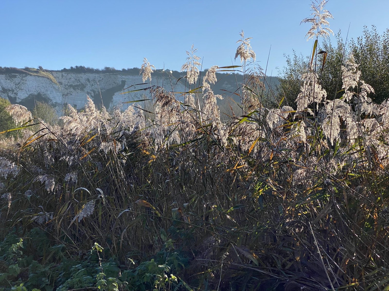
By walking under the bridge onto the water meadow you can walk into town along the Ouse into Town to the Railway Land and enjoy views of distinct white chalk of the Cliffe.
The Winterbourne from source to the Ouse, Lewes, East Sussex


The Winterbourne is a fascinating seasonal stream which runs through Lewes from a spot just east of the Starbucks (formerly the Newmarket Inn) running alongside the A27 Brighton Road heading east, through Lewes, and entering the River Ouse from the Railway Land Wildlife Trust next to the Linklater Pavilion.

Marcus Taylor, who has lived in Lewes since the late 1960s, taught Geography for 35 years and was a trustee of Friends of Lewes for a decade explained the history of geography of the Winterbourne in an illustrated talk; it was the inspirations for this post and my own research.


The word ‘Winterbourne’, describes what is, for much of the year a dry channel. It is a stream or brook that is ‘born again’ in the winter, once the water table has risen high enough – though it failed for two years in the late 1980s and some years will be late to run, and early to run dry. Living close by for the last 15 years I can record that the Winterbourne has run, even flooded occasionally, though never earlier than December and then sometimes lasting in flow through to early May before drying out completely for the rest of summer and autumn. That said, adding this note on 22 June 2023, after a wet spring, the Winterbourne is slow flowing.

The source of the Winterbourne lies somewhere west of the former Newmarket Inn (a Starbucks since the early summer of 2023). The spring is illusive – it is somewhere in a ditch between the A27 and the railway in the lowest lying land that drops down from the Downs north and south. It is only obvious when the water table is high.


Anyone travelling regularly on the A27 will be familiar with flooding between the Ashcombe Roundabout and Newmarket Inn, for short spells these days after intense rainfall (early September 2022) or every five or so years in December after a longer period of rain when the water table has been saturated.
In the 1960s water flooded the Brighton Road and was photographed flooding off the Downs in a torrent. It did the same in October 2000 – a harbinger of flooding across the low lying parts of the town.
From an inauspicious start in a hard-to-find spring, followed by a short section of ditch, the Winterbourne, in short order, somewhere around Ashcombe Hollow, is channelled under the A27 dual-carriageway, the roundabout and Bright to Lewes rail line, only to reappear intermittently (if at all) as a stream or ditch between the Brighton Road into Lewes and Hamsey Riding Stables. It finally emerges from a large drainage pipe or tunnel next to Houndean Allotments.


The banks of the Winterbourne are dark and damp enough to favour ferns. On the right the oh too close A27 dual-carriageway thunders by; at one spot (there must be others unless everything is funnelled in through this one spot) the A27 run-off drains into the Winterbourne.


On the opposite side are Houndean Allotments. This year there was some water flow along the higher reaches of the Winterbourne from 17th October.


Onwards under a canopy of leaves in summer you might spot the four strange sculptures before you get to a patch of lawn and Lewes Pigeon fanciers.


Once again, the Winterbourne is channelled under the Brighton to Eastbourne rail line, only to emerge close to the detached houses along Glebe Close, running in a ditch by the road opposite the WInterbourne Stores and over the back garden fences of houses along Winterbourne Close.


The Winterbourne then runs along Winterbourne Lane, close to the road and verges on its northern bank and abuts to the rear gardens of Winterbourn Close to the south. At the foot of Delaware Road there is a measurement station.


The Winterbourne then runs under Bell Lane and along Winterbourne Mews.
Sadly there is an issue with garden and household waste being dumped over the back of garden fences here and fly tipping from the lane.


This is another stretch of road often prone to flooding with rainwater quickly pooling in the south-westerly corner of Bell Lane Park exactly where there is a pedestrian crossing.


The Winterbourne is culverted on two sides by concrete and walls behind the stone or flint walls of the Cemetery on one side and Bell Lane on the other.


Historically Bell Lane has flooded, turning it into an impromptu lake on one occasion in the late 1960s. There were floods the length of the Winterbourne through to St Pancras Stores and beyond in October 2000, and before that in 1915 and 1911.

There is another measuring station where the Winterbourne leaves Bell Lane Park where these ia an impressively old pollarded willow bricked into a garden wall.


As it passes through the south of the town the Winterbourne is either culverted or covered. Grills at various places where the Winterbourne enters a tunnel collect flotsam and jetsam and are from time to time cleared by the Environment Agency.
The Winterbourne is culverted for the last stretch of Bell Lane, going under the houses at St. Pancras, emerging for a short section by St Pancras Stores, then disappearing under St Pancras Road. This is site of some historic photographs of flooding at the beginning of the 20th century.

It then passes under The Course, under Southover and Western Roads Schools and sports fields only to re-emerge in Southover Gardens where it is a feature of Grange Gardens.


It then passes out of sight once more …
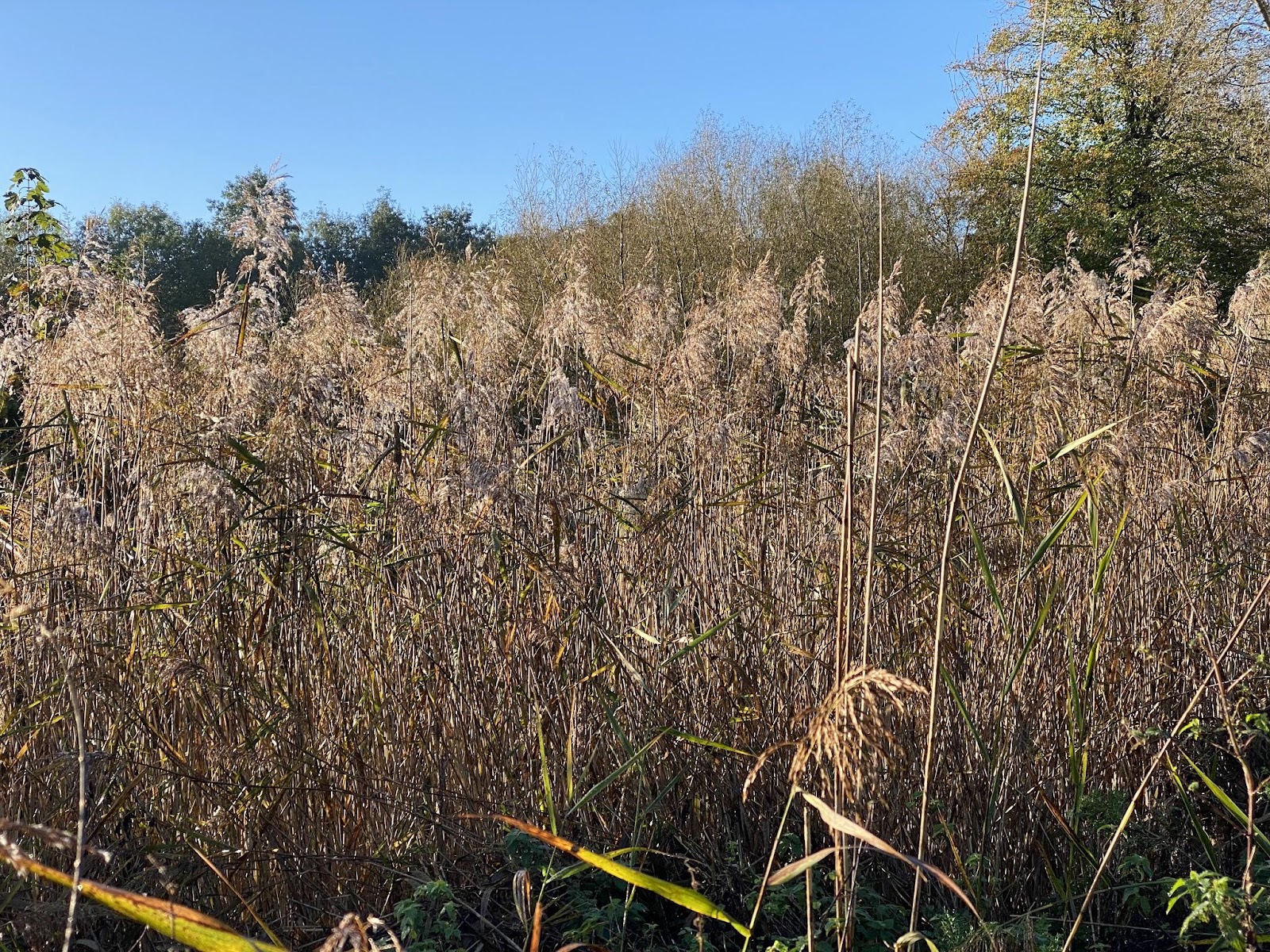
… passing under Gardens Street, the houses of Tanners Brook and the old Market, then under the Railway Station and lines to London/Eastbourne only to re-emerge just north of the rail line to Eastbourne, in an area that once included a manor house and formal gardens, the line to Uckfield with numerous sidings – it is now collectively the Lewes Railway Land Wildlife Nature Reserve, which includes the former gardens and pond of Leighside House.


The Reserve consists of five distinct sections: a wet wood (former Leighside House Gardens), the Heart of Reeds, the developing meadow created where the railway sidings were most densely packed, the former allotments, the river bank and the water meadow.


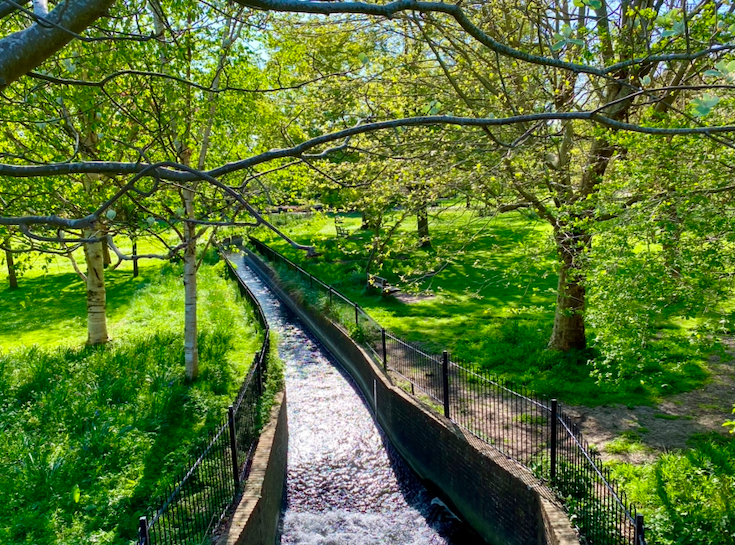
The Winterbourne passes through the former gardens of Leighside House with its restored pond and viewing platform to the north by the entrance from Court Road and then winds its way towards the River Ouse which it enters via a sluice just to the south east of the Linklater Pavilion. Currently (June 2023) works have begun to restore the Winterbourne’s natural features.

This will create more diverse habitats with deflectors fixed in the channel to create a variety of water depths, eddies and pools; brushy berms to create narrower areas to create faster water flow and planting țo create dense thickets and copses for wildlife.


In March each year grey mullet can sometimes be seen in. a large shole by the spot where the Winterbourne joins the River Ouse.


And so, for now, ends my story of the Winterbourne, which can only be followed by adding stories of these who lived beside it: those keeping horses in the fields alongside the A27, people who have an allotment in Houndean, the pigeon fanciers and sculptor, the dog walkers and runners, those with gardens abutting the Winterbourne, use Bell Lane (recreation ground), living on Rotten Row, St Pancras and the Grange, along to Southover Gardens – its house, cafe, Sussex Arts & Crafts gallery and annual skittles show, to the station and beyond to the stream’s terminus in the Railway Land Nature Reserve with its hub, the history of the old railway sidings and Leighside House and gardens, the Linklater Pavilion and the constant activity it attracts.
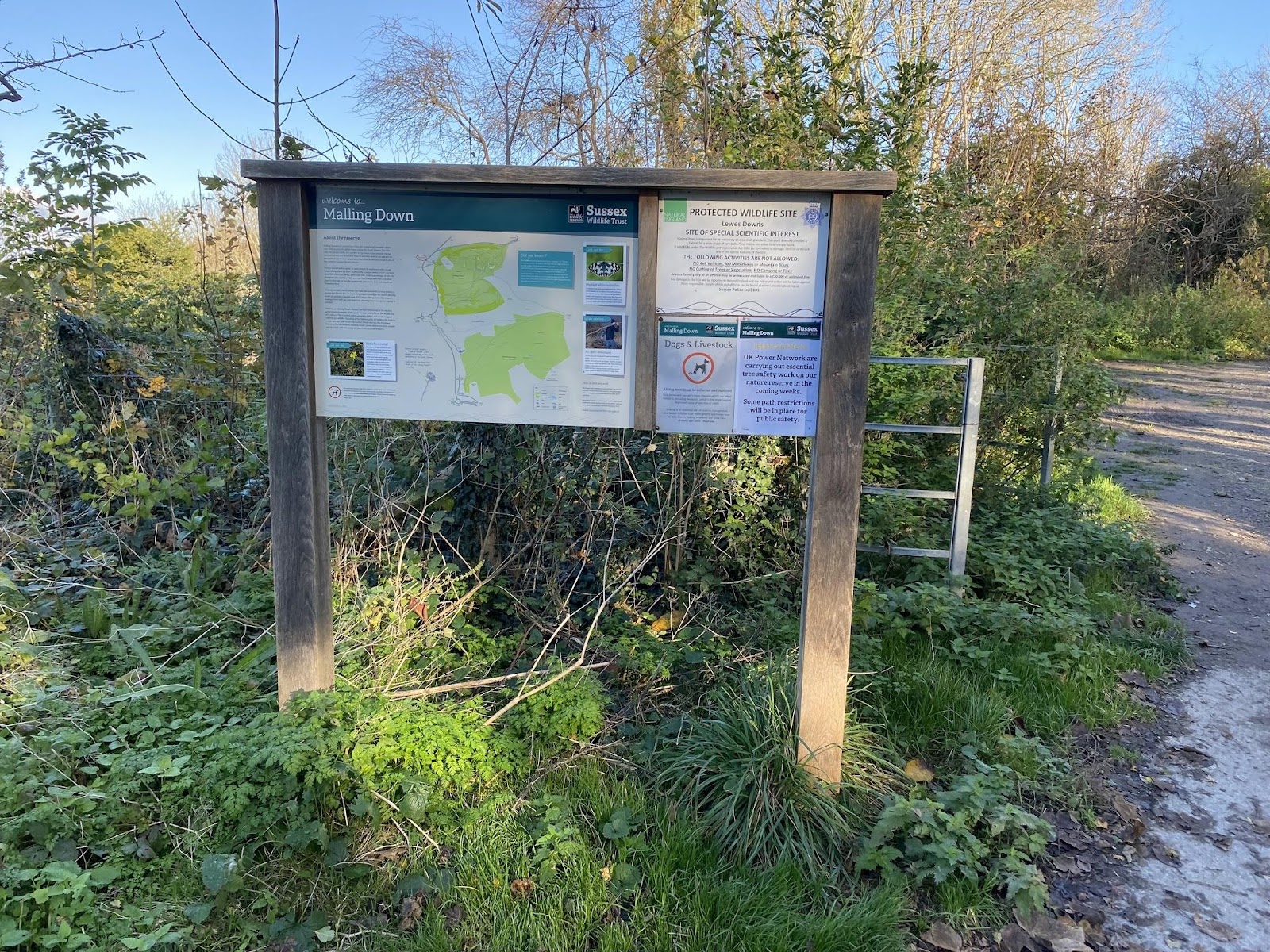
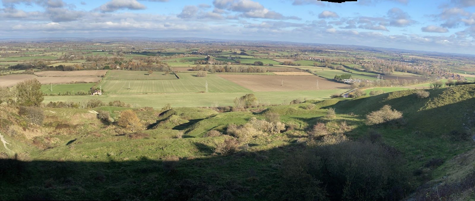
Malling Down Nature Reserve, Lewes Sunday 21st November 202
I have to admit to ticking off a walk out of Lewes I have never done before, although I have approached parts of it from the north and south. My desire is to see autumn trees but with the sun so low we decided to keep out of The Combe.
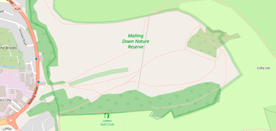

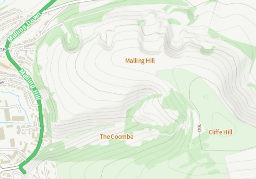
As each of these maps from OpenStreetMap, Google Maps and Ordnance Survey show the same thing: a strip of trees in the shady lee of the coombe. Instead we parked on the street off Malling Hill and took a path onto Malling Hill to Cliffe Hill, walked around the side of Lewes Golf Course then battled a chill northerly wind to the old chalk pit and the walk back.
I can’t say I took much pleasure in it.
In a ridiculous over statement Sussex Wildlife call the Malling Nature Reserve ‘a superb chalk grassland and scrub’. The same author calls Lewes ‘quaint’. The clichés depress me.
I would call Malling Nature mediocre; it gives the impression of a patch of exposed Downland that is overgrazed, over managed and over trod. It is an urban park, a dog and human playground squeezed in against the edge of a popular town with busy roads in ear shot and a golf course along its southern boundary.
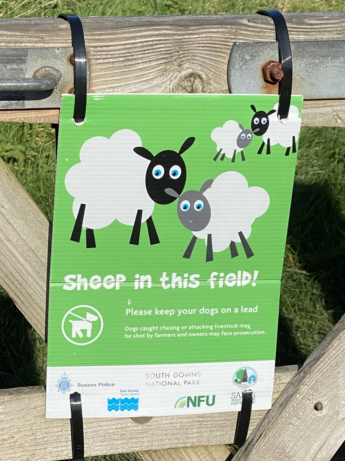
There are multiple gates to negotiate each with a set of signs with conflicting messages regarding ownership, what you should or should do with your dog and the presence of sheep in the field (or not) – though there were no sheep present anywhere when we visited. The signs warning of sheep are secured by clips to the wooden gates and are clearly left in place regardless of whether there are sheep present or not. Someone has not been told the story of the boy who cried ‘Wolf!’. Ignoring the signs is inevitable.
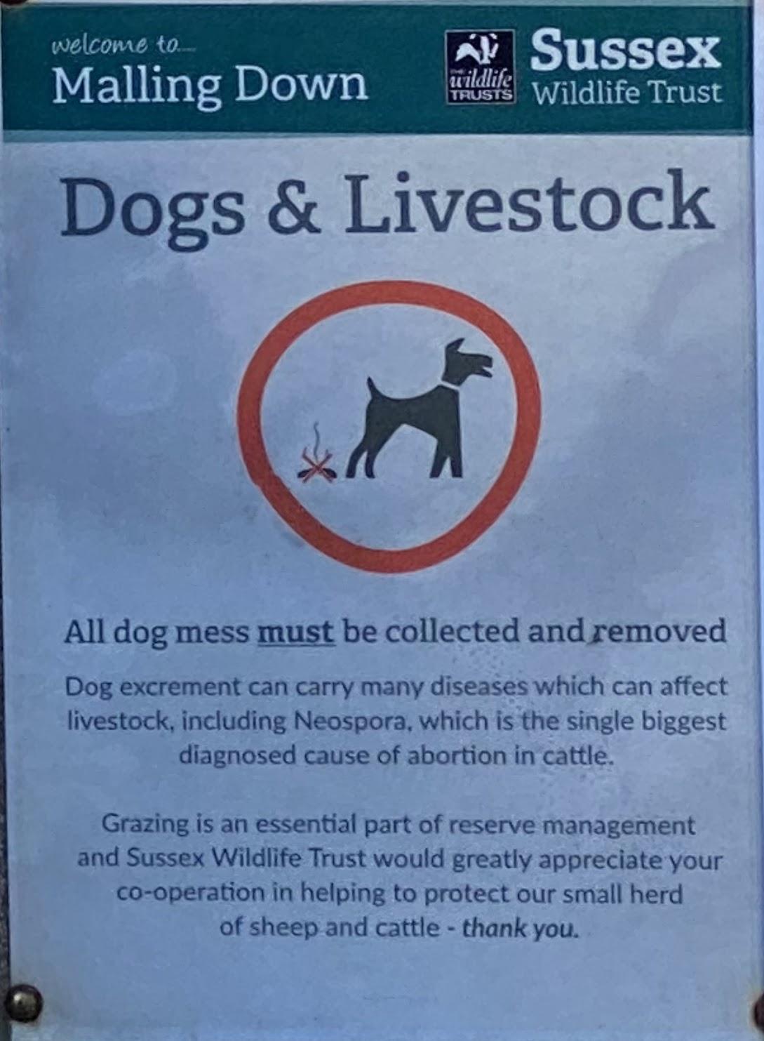
Here at least the importance of picking up dog shit is explained; on the Landport in the distance across to the west of the town and visible from Malling Hill the attitude I have had expressed to me in person on the ground and online in meetings of the Friends of Landport Bottom that on ‘open countryside’ dogs can do what they please, were they please.
The Railway Land Wildlife Trust
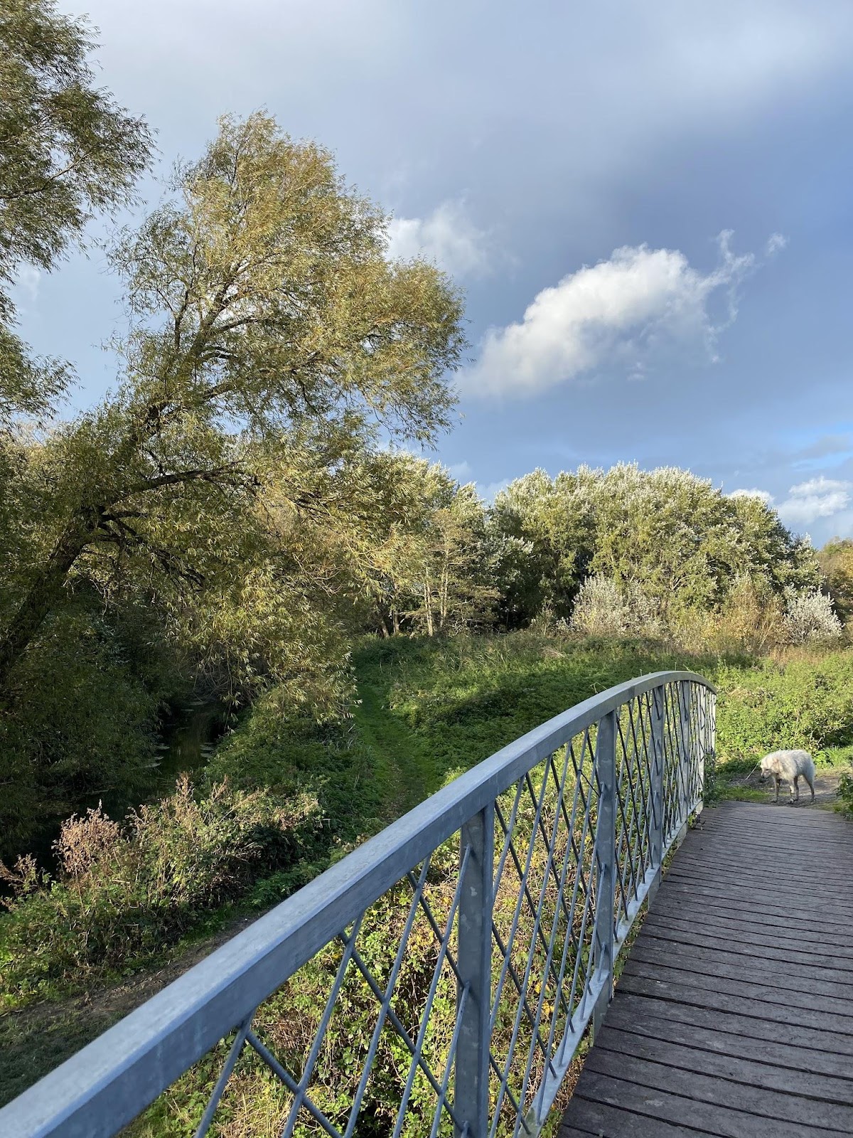
There are days when I visit The Railways Land Wildlife Trust land in the morning and late afternoon without fail – and more often if they have an event on.
Longer walks are now being measured by how long we have been told our dog Evie should be out – 20 minutes, not an hour or more. So we do a short circuit taking a different route each time we return.
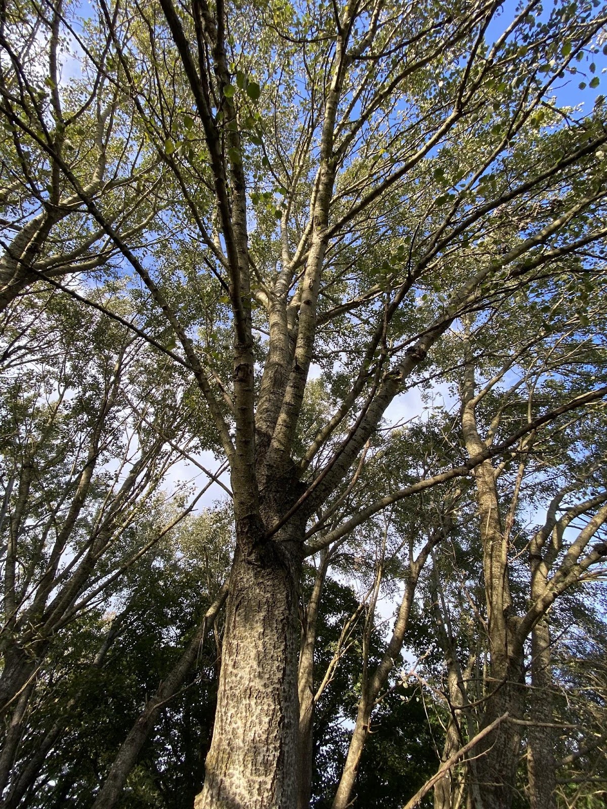
A morning walk on the Railway Land with heavy due glistening in the low sun. Capturing the delicacy and brightness of due on the rushes needs something better than the lens in my phone, but who carries around a DSLR anymore?
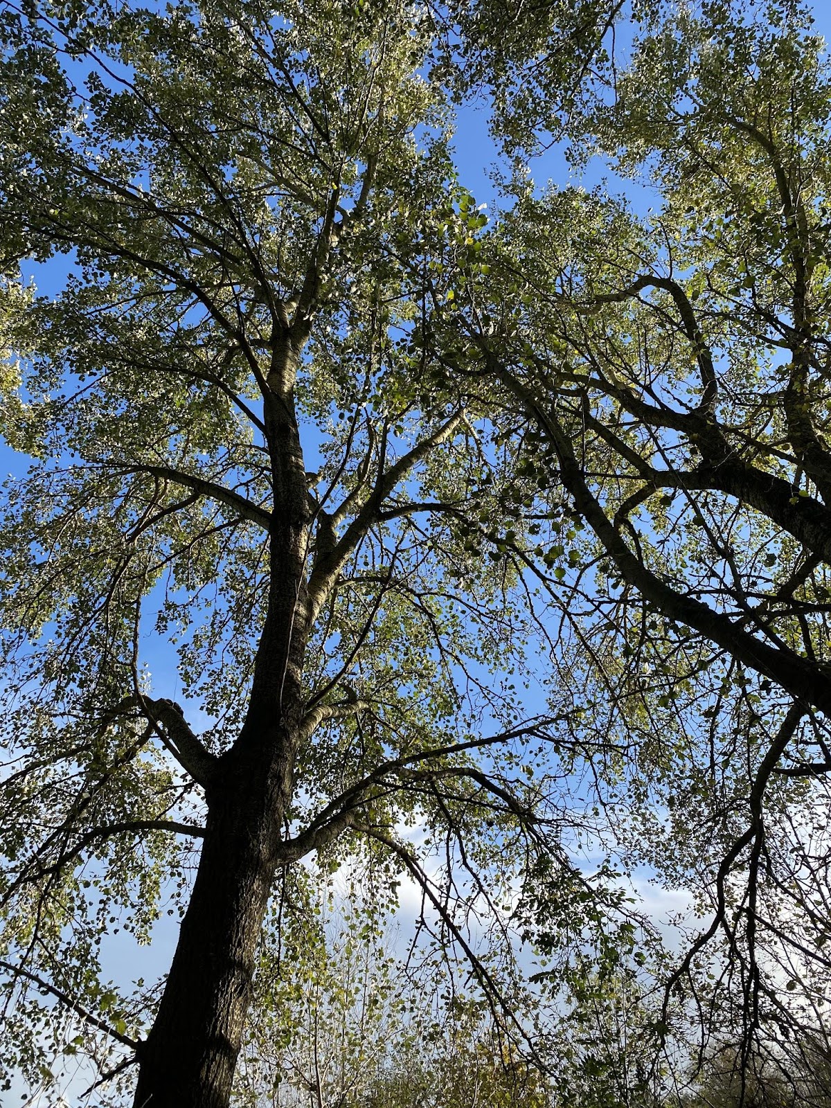
Lewes Present tells me I am looking at White Poplar here, something I confirm by putting some closer images through the App Picture This and then reading up some notes from The Woodland Trust.

From the Woodland Trust British Trees App
The thing I should look for is this bright, white shininess in the canopy. Knowing that the underside of the leaf is paler than the upper side explains the effect they produce as you walk around the trees from a distance.
The visit ends at Bake Out for a coffee, or later in the day at the John Harvey Tavern for a pint of Harveys.
Lewes has it all. Though some benches along the river bank would be welcome. A project for the Town Council.
Sustainable Transport Lewes
(Response by Jonathan Vernon. Green Party Town Council Candidate, Castle Ward)
Lewes Cycle Planning
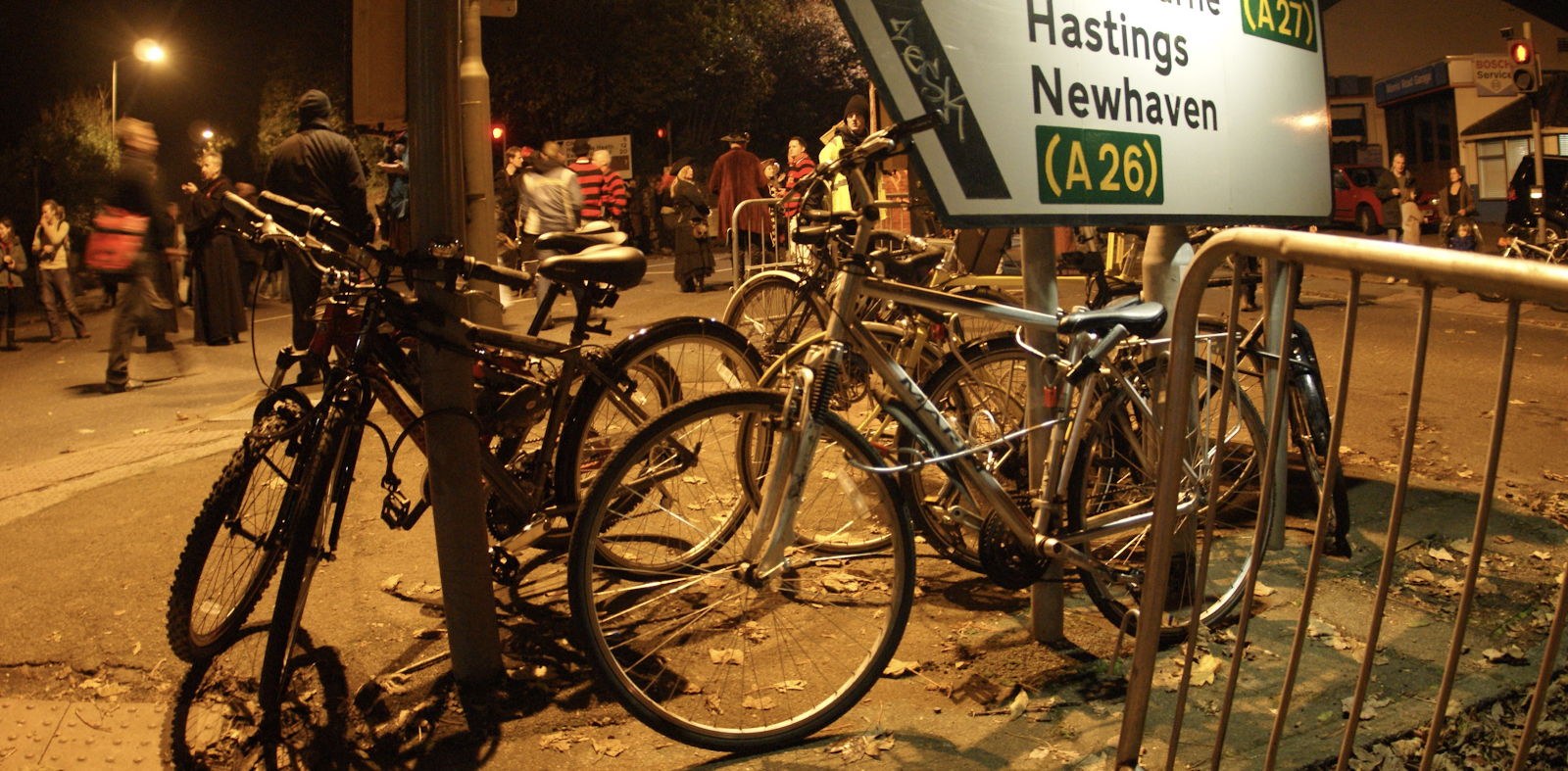
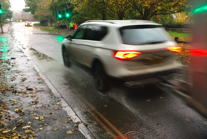
Bikes at the Prison Crossroads on the entry to Lewes. 5 Nov.
Leading up to 5 November parked motor vehicles disappear from the streets of Lewes and in the day during the afternoon all motor traffic clears. Imagine a Lewes like that all the year round. Imagine only pedestrians and cycle ways. Perhaps for a planned hour before the marching a parade of cyclists in fancy dress could take place to celebrate the freedom to move around the streets. Perhaps this could lead the way to changes to limit or restrict motor traffic in favour of pedestrians and cyclists.
Here we mean provision for cyclists age 8 to 80, upright on workaday bikes for shopping, going to school and commuting rather than helmeted, brightly clad racing cyclists.
To be successful a ‘Cycle City’, as they have come to be called in the Netherlands, requires a complete and comprehensive network that is both attractive and comfortable. Partial fixes, barriers and signage can just add to the clutter and confusion. Change needs to be more subtle with wider paths, cycle priority and trees as calming measures.
And some societal and cultural shift too is needed, from cafe culture to cycle culture, with shops reclaiming the streets where parking bays have been removed to allow them to create a terrace environment. The town should be one of 5 minute cycle rides, 20 minute walks and regular trains to other towns. It also needs to be a town centre that is attractive to people free of outsized motor vehicles, their noise, pollution and threat.
a) Hard measures (infrastructure: shared space, improved crossings, dedicated cycle paths removal of restrictions on cycling, traffic calming, new shared pedestrian/cycle routes, safe crossing points)
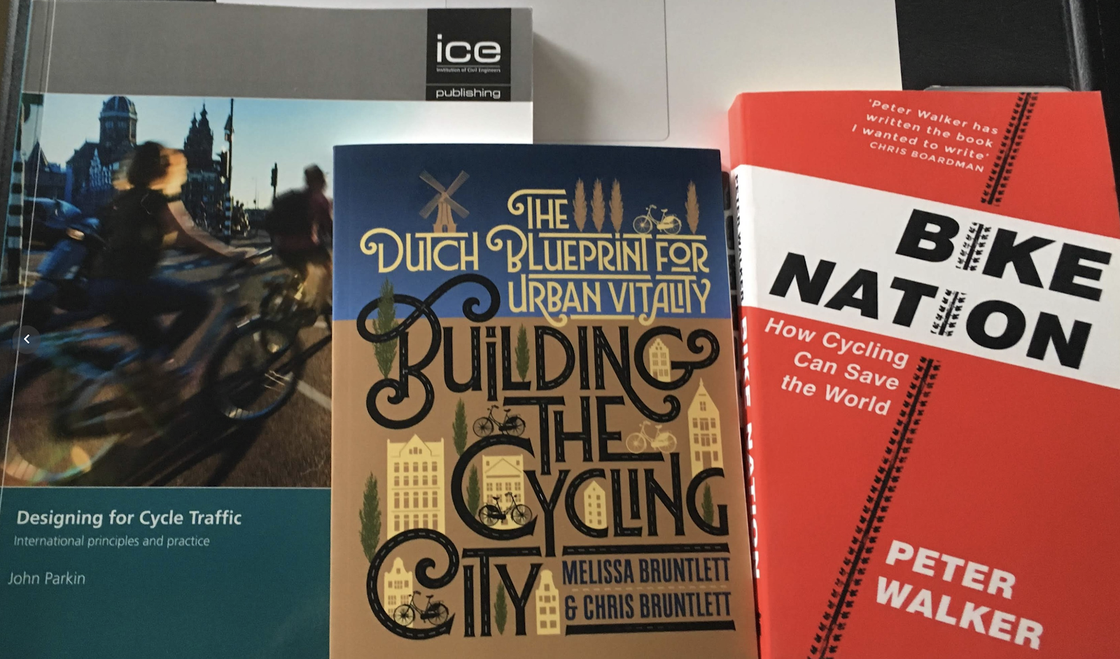
‘Every location is different, and it’s never as simple as copying and pasting their methods’, write Chris & Melissa Bruntlett in ‘Building the Cycling City’.
Lewes has many narrow, twisting streets and lanes, often with significant pinch points. Achieving the desired separation between motor vehicles and cyclists, and between cyclists and pedestrians will only be possible – some of the time, in some places by taking out parking or even reducing two-way traffic to one-way. This is the challenge for Lewes. Cyclists need a comfortable, safe journey the entire way from home to destination, not just here and there.
FThere are measures though:
Enforcement of 20 mph with roundels on the road and signage.
A significant volume of large vehicles in the 20 mph zone is a deterrent to cyclists. Lorries need to do their deliveries before 7:30am, not parking up on the kerb on the High Street throughout the morning from 8:30am. Buses are a problem and a solution. Cyclists and buses should be kept apart.
Traffic can be tamed with traffic calming to make sure it travels at under 20 mph.
If there’s any major difference in speed (anything over 20 mph), then full separation is required with concrete barriers, a grass median, planter boxes, or bollards.
As we know, the 20 mph speed limit is often broke. Living in the Winterbourne too often vehicles using the rat run between Brighton Road and Bell Lane think they can finally pick up speed along Winterbourne Lane which is already home to closely parked parked vehicles.
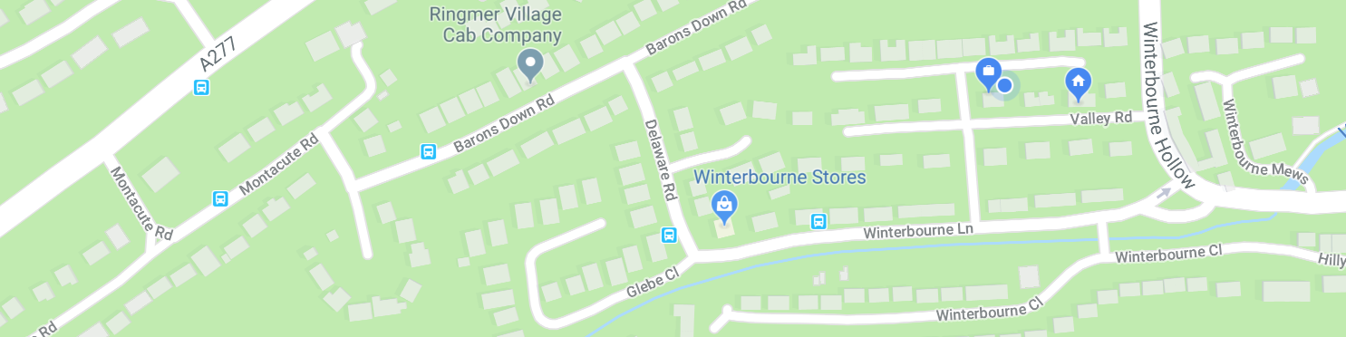
This ‘rat run’ down Montacute Road, along Barons Down Rd, Delaware Rd and Winterbourne Lane is circumvented in part by cyclists using the path between Delaware Rd and Valley Rd, just as they will use the pedestrian path through Bell Lane to St Pancras Gardens – with good reason. It isn’t only more direct, it also avoids the dangers of the mini roundabout at The Swan Inn and at the weekend the vehicles parked up on the kerb along Southover High Street.
Here, like so often in Lewes, a narrow road, with a narrow footpath, with parking bays and cars parking up over night and through the day on the single yellow lines at weekends and bank holidays, becomes quickly clogged at various points, made far worse when there are multiple double-decker replacement buses from the station trying to get along here too.
There will be similar stories right across Lewes.
Too many vehicles, large and small, pedestrians and cyclists, mixed with residential street parking and deliveries creating an environment that can be unpleasant for pedestrians, let alone cyclists trying to use the road.
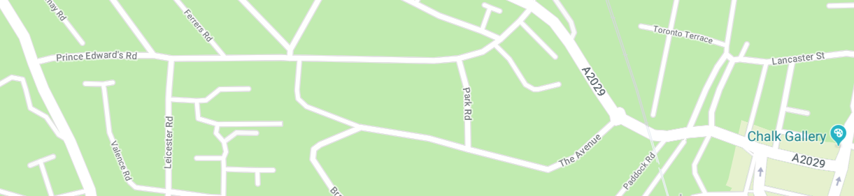
Another ‘rat run’ to avoid the frequently jammed High Street is off Nevill Rd, down Prince Edward’s Rd, then dogleg down Park Rd and The Avenue onto the A2029 into the centre of town. Where else is the quality of the environment and safety for cyclists and pedestrians in residential areas being compromised because of the atrocious state of traffic on the High Street?
All opportunities to improve pedestrian as well as cycle access to the centre of town need to be explored, including a foot and cycle bridge from South Street.
Motor vehicles can be banned from overtaking cycles though signage has to be clear and can be difficult to enforce legally.
After this:
Restrictions to casual parking on single yellow line kerbs especially at weekends.
Potentially reduce some street parking to make cycling safer in the already narrow roads.
If feasible limiting access by lorries to hours where cyclists are less prevalent.
The physical size, speed and frequent stopping makes it a problem for cyclists to share the road with buses.
Shared space is a last resort, ideally pedestrians, cyclists and motor vehicles should each have their own routes.
In France there is often a two way cycle lane on one way streets so that cyclists do not have to go the long way round.
Parts of Lewes appear suitable for mixed use where road-markings are removed and pedestrians and slow moving vehicles mixed. However it is often here that faster cyclists need a dedicated lane.
The pedestrian bridge at the Pells to be wide enough for cyclists and a second pedestrian and cycle bridge from South street across the Ouse.
Better, bolder end to end cycle parking where it is most needed. Close to amenities.
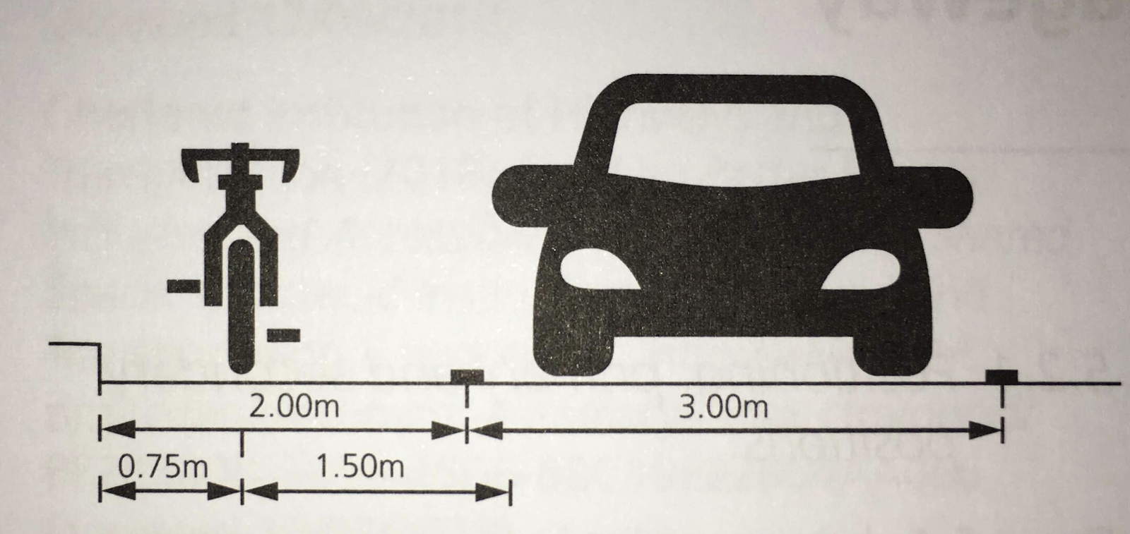
The Dutch model is for cycle tracks that are paved with an easily identified inch-thick top coat of dyed red asphalt. It’s everywhere throughout the Netherlands — you know when you’re on a cycle track. But does Lewes have the space for this? Not without restricting parking and two-way flow of traffic.
On busier roads the cycle ways need to be completely separated – anywhere the speed of motor-vehicles is over 20 mph.
The Dutch have taken the concept of the protected bike lane and carried it through the intersection. More often than not, there is physical protection on the corners where there’s cars turning right or left. There’s are often mid-block protection provided as well, so that you don’t feel exposed. The raised cycle track is also carried through the intersection. Through design, they’ve made the cycle track a priority — visually and physically. (John Parking, Designing for Cycle Traffic).
To achieve this at junctions in Lewes significant investment, even compulsory purchase orders would be required to remove walls, even buildings. This is unrealistic, therefore restricting speeds, and restricting access by certain kinds of larger vehicles is required.
Creation of clearer routes to Priory School so students can feel they can cycle from the key residential areas.
Give way junctions, roundabouts, signals and crossings all need thought.
b) Soft measures (promotion of cycling and education, driver education)
Parental support for children learning to cycle with group based support.
Have spaces where children can learn to cycle safely.
Promoting cycling in schools.
The concept of cycling starts getting introduced to a lot of kids in preschool. They’ll run around on these push bikes. But the biggest education — while it’s not mandatory throughout the country, it’s done by most schools — is students around grade four or five, in the 10 and 11 age range, start taking cycling skills courses.
Between the ages of 11 and 12 they have to take a written exam to show that they understand the rules of the road. They also do a practical exam. So, every year, dozens or hundreds of Dutch students go out onto the street and travel on their routes to get to school, on a designated pathway. The Fietsersbond, which is their national cycling advocacy group, puts the kids right in real life situations, navigating their streets, knowing when to turn, how to signal, where to stop. (John Parkin, Designing for Cycle Traffic).
Known for closing the centre of town temporarily for marches could this be done to celebrate cycling and have a cycle route circuit.
PR and Social Media Campaign, and online education.
Initiatives such as ‘Car Free Sunday’, even ‘Car Free Sunday Mornings’ would be a start.
Also ideas promoted such as ‘Bike to Shop Day’, ‘Bike to School Day’ and ‘Bike to Work Day’.
c) Current reality – speeding traffic (above 20mph), increase in vehicles using Lewes as a through route and increases in traffic from new developments in town, inappropriate and dangerous parking and close passing often result in dangers to cyclists (and pedestrians)
This reality needs to be tackled firmly. Only at 20mph or less does it feel safe for cyclists to share the road. Though this doesn’t feel any safer where there are a lot of larger vans, lorries and buses. The real need is for a Rapid Transit System linking up Lewes and Ringmer to Brighton. ‘Cars parked here will be removed’ is a sign I have come across that needs to be used around Lewes.
All roads that are one way for motor vehicle traffic should be two way for cyclists.
d) Perceptions that roads are unsafe is one of the main barriers to cycling
The perceptions are real. Unfortunately Lewes suffers from too much traffic, including large vehicles and narrow streets made worse for dual used because of parking provision. Do away with all street parking and a cycle lane could go in – but that would surely prove unpopular and impossible to enact. The incessant replacement bus services has double decker buses forever on Southover High Street and Bell Lane. Vehicles of this size, like the vast freight lorries that sometimes end up in the wrong place, are unsuitable for Lewes Roads.
Convenient, easy and attractive cycleways from somewhere to somewhere – not tokenism. They must be relevant to real travel needs. From homes to schools, to stations, bus stops, shops, the Leisure Centre, Pells Pool and cinema.
With secure parking and signage.
e) Would you campaign for greater investment in cycling to ensure that 10% of the transport budget was spent on cycling?
It has required ‘courageous political leadership’ elsewhere to overturn urban planning of the 60s and 70s and since that has favoured the motorcar. Lewes was saved from having its centre carved out to make way for a wider through road down the High Street. Even the bypass is a comprise too close to town that blights us with noise pollution. Something has to be done to reduce single occupant vehicle use clogging the streets, not least the vehicles coming in to the ESCC buildings as well as measures to dissuade so many parents from driving their children to our local schools that are a short cycle or walk away.
Include pedestrians as well as cycling as two valuable alternatives to the motor vehicle which both ideally requiring separate paths and cycle ways.
f) How would you support the building and maintenance of dedicated cycle infrastructure, reallocate space, redesign of existing road and paths suitable for cyclists of all ages and abilities.
This is a very tall order for Lewes. We are not designing on a flat greenfield site. The challenges in Lewes are considerable because of its history and infrastructure and too much planning in the 1960s and since that put the motor vehicle first.
Getting the volume of traffic down is key, and getting fewer large vehicles too when cyclists want to be out. Seeing the ESCC move to Polegate might reduce incoming traffic to an in town car park … or site this on the edge of town and have a park and walk/cycle scheme at both ends of town.
g) What local action would you support?
The issues with motor vehicles are multifarious : speeds, pollution, volume, size, parking …
Dutch experience: We make a differentiation between the hunched-and-helmeted cyclist and the upright, bare-headed cyclist. Upright, everyday cycling, a form of walking-with-wheels, is far more broad, inclusive, accessible, and appealing to people of all ages and fitness levels. It isn’t just about getting from A to B as quickly as possible, it’s about enjoying the ride.
h) How should the Councils use the experience of cyclists when designing cycle facilities?
The behaviours of cyclists even where they are ignoring restrictions, like pedestrians taking shortcuts indicate a potential solution to a problem rather than something to police and punish.
There are lessons to be learnt from around the UK, but also in Denmark and the Netherlands. New housing and work spaces need to be designed with pedestrians and cycle use prioritized over the motor vehicle.
As well as cyclists, we need to talk to pedestrians as those on foot, on bikes or in motor vehicles need to be given separate provision and as often as possible kept apart.
Further Reading
17 November 2016 1913-1914

Order books from Amazon related to 1914: two on Kindle and the Peter Simpkins’ book on Kitchener’s Army in print. All to set the scene, and cover before, during and after the two week episode where 11,000 recruits to Kitchener’s Army turned up in Lewes, a Sussex market town with a population of a little over 10,000 and had to be billeted.
I feel I am speaking out the broad background to events in Lewes but need specific reports, letters or diaries to provide the necessary detail. Should I find out in which houses they stayed and locate the public buildings? How were they fed? Where were the entertainments held? Will the Regimental Diary for 22nd Division tell me anything? How many Lewes men had either gone to France or were in training in another part of the country as Territorials or as new recruits?
I’m on antibiotics and prescription painkillers to try and tame my sinus pain. I am dehydrated at night and have a migraine like headache all the time.
 |
| From Lewes, East Sussex |
The River Ouse at Southease, The South Downs Way
Walking and taking photos yesterday afternoon after a morning writing – for me that was 4.30 am to 11.30am I resolved a character/plot issue in a novel I am challenging myself to complete in first draft in a month. This is part of an online ‘Write a Novel in a Month’ thing that has been running since 2002: recommended. It has all the joy and connectivity of learning in a supported environment that you could want.
This is an OU course too. A lot is said about keeping a notebook. I have ‘issues’ with this.
During this walk I decided that I had to make the protagonist’s only friend his nemesis and enemy. I also figured out a story that has been on my mind for 25 years about a 9-year-old girl buried in a school garden … however, there was something else knew that I thought I’d remember but had forgotten by the time I got to the car I could have tapped a cryptic message on the phone’s notepad, phoned home and left a message on the answer-phone, recorded a note on the iPhone, or scribbled a note had I pen and paper … the issue I have is that when you develop a habit of jotting down ideas it can bring your life to a grinding halt: you stop to take notes, pull over in a lay-by to write something down, let something burn in the kitchen, don’t answer the phone, wake up in the middle of the night repeatedly … this happened to me. I could not sleep for long without having an idea about something. And then I ended up managing that database, and having more ideas in a crushing spiral of brain pain no gain self-defeating, bean-counting, self-analysis, deconstructive, non-creative nonsense. Be warned
The answer is to work as a tree surgeon. My solution is to fill a reasonable part of my life, paid and as a volunteer, teaching and coaching swimming to kids, adults and disabled people. That keeps my head, hands, feet and soul gainfully occupied.
Learning can be an obsession; look at me. I know that learning with The OU fills such an important space in my life that even when the money has run out I want to keep doing more
